Karkar Island
A fertile volcanic island off the Madang coast, densely settled and planted with coconut and cocoa around an active crater.
Updated 21 October 2026
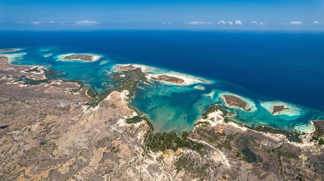
Karkar is a volcanic island of around three hundred and sixty square kilometres off the Madang coast, essentially a single stratovolcano rising to around 1,800 metres with a caldera at the top containing an active cone, and the volcanic soil makes it one of the most fertile and densely populated islands in the country, planted with coconut, cocoa and food gardens and carrying tens of thousands of people. Plantations established in the colonial period still operate. The volcano is monitored and has erupted repeatedly, most severely in 1979. Climbing to the crater takes a full day with guides from the villages. Access is by boat or light aircraft from Madang.
History
The first recorded European sighting was by the Spanish navigator Iñigo Órtiz de Retes on 10 August 1545, aboard the San Juan on a voyage from Tidore towards New Spain. Willem Schouten and Jacob le Maire later called it "High island", Abel Tasman passed in 1643, William Dampier probably visited in 1699, and the volcano erupted in 1895 (Wikipedia, Karkar Island).
What you'll find
- The volcano - the caldera and the active cone at the summit.
- Plantation country - the coconut and cocoa covering the lower slopes.
- Village settlement - the dense population around the island.
- The crossing - the boat run out from Madang.
When to go
May to October for the calmest crossings and the driest walking; the wet season makes both difficult. The summit climb is a full day and needs guides arranged in the villages.
What to expect
Crossings are by open boat and depend on sea conditions. There is no tourist accommodation; staying means village arrangements. The volcano is active and access can be restricted. The climb is long and hot with no facilities.
Nearby
Madang lies south across the water; the Bismarck Sea surrounds the island.
Key facts
Source: Wikidata, item Q720720, read on 18 October 2026.
What to pack for Karkar Island
Chosen from what this place is for. Tap a kit for the full checklist.
- Reef-safe sunscreen - High SPF that will not bleach the coral you are swimming over. Find on Amazon
- Quick-dry towel - A microfibre towel packs small and dries in minutes. Find on Amazon
- Water shoes - Protect your feet on rocky entries, hot sand and sea-urchin spines. Find on Amazon
- Dry bag - Keeps phone, cash and keys safe while you are in the water. Find on Amazon
Some links on this page are Amazon affiliate links - if you buy through them we may earn a small commission at no extra cost to you.
All packing kitsPlan your trip
Where to start if Karkar Island is going on the list.
Booking links on this page are affiliate links - if you book through them we may earn a small commission at no extra cost to you. It never changes what we write about a place.
Opening times, ticket prices and seasonal closures change - check the official source before you go: official site.