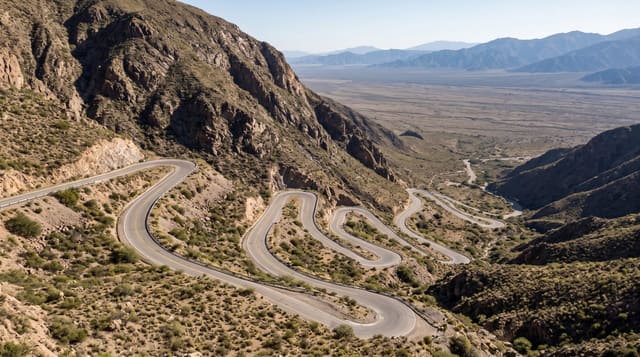
Makran Coastal Highway
A road running some 650 kilometres between desert cliffs and the Arabian Sea, from Karachi towards the western coast.
Updated 21 October 2026
The N10 was completed in 2004 and cut the journey from Karachi to Gwadar, which had taken at least two days on a dirt track, to six or seven hours. It runs for some 650 kilometres with the sea on one side and, for long stretches, eroded cliffs and badlands on the other, passing through Hingol National Park with its mud volcanoes and rock figures, the fishing settlements of Ormara and Pasni, headlands where the road climbs to viewpoints over empty beaches, and finally the hammerhead peninsula at Gwadar. Traffic is light, the surface is generally good, and the emptiness is the defining quality: there are stretches of an hour with no settlement at all. Fuel and food stops are far apart and worth planning around, and travellers are asked to register at posts in places, which is routine along this route.
History
Before the highway, Karachi was linked to Gwadar by a dirt track and the journey took at least two days, so many preferred the longer route through Quetta. The Frontier Works Organisation, which had built the Karakoram Highway, began work in 2002 and completed the 653-kilometre road on 14 December 2004, cutting the trip to six or seven hours (Wikipedia, Makran Coastal Highway).
What's there
- Cliff and sea driving - long stretches with the Arabian Sea beside the road.
- Hingol rock forms - the Princess of Hope and Sphinx beside the highway.
- Fishing towns - Ormara and Pasni with their harbours and boats.
- Empty beaches - long undeveloped sand at intervals along the coast.
When to go
November to February; summer is very hot and humid, and monsoon weather can close sections. Travelling in daylight only is the standard advice for the whole route. Allow more days than the distance suggests to enjoy the stops.
Practical notes
Fuel stations are sparse, so fill up whenever possible and carry water. Accommodation is basic and concentrated in the towns; camping is common. Arrangements for foreign travellers vary, so check current requirements before setting out. Mobile coverage drops for long stretches.
Nearby
Kund Malir and Hingol are on the eastern half; Gwadar is at the western end.
Key facts
Source: Wikidata, item Q6740063, read on 18 October 2026.
What to pack for Makran Coastal Highway
Chosen from what this place is for. Tap a kit for the full checklist.
- Travel rod + reel - A packable multi-piece rod fits in a case and covers most holiday fishing. Find on Amazon
- Reef-safe sunscreen - High SPF that will not bleach the coral you are swimming over. Find on Amazon
- Loose, light, long clothing - Covering up beats bare skin in the desert - and locals dress this way for a reason. Find on Amazon
- Strong insect repellent - DEET or picaridin; the jungle is where bites and disease risk are highest. Find on Amazon
Some links on this page are Amazon affiliate links - if you buy through them we may earn a small commission at no extra cost to you.
All packing kitsPlan your trip
Where to start if Makran Coastal Highway is going on the list.
Booking links on this page are affiliate links - if you book through them we may earn a small commission at no extra cost to you. It never changes what we write about a place.
Opening times, ticket prices and seasonal closures change - check the official source before you go: official site.