Gwadar
A port town on a hammerhead peninsula, with a flat-topped headland, cliff-backed beaches and a deep natural harbour.
Updated 21 October 2026
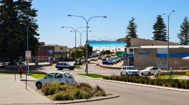
Gwadar's geography is unusual enough to be visible from space: a flat-topped rocky headland called Koh-e-Batil hangs off the coast, joined to the mainland by a narrow sand isthmus, so the town sits on a hammerhead with sea on both sides and two bays, east and west, of very different character. The headland gives a viewpoint over the whole arrangement, with the fishing harbour below and the deep-water port on the eastern side. Beaches run in both directions, and beyond the town the coast holds sea cliffs, arches and the strange flat-topped mesas of the Makran, including the Princess of Hope further east. Gwadar was ruled from Oman until 1958, and Omani influence lingers in the old town's architecture and in some family names. Development around the port has grown quickly and unevenly.
History
The name joins the Balochi gwát, "wind", and dar, "door", so Gwadar means "the gate of wind", and the area has been settled since the Bronze Age. The Ottoman admiral Seydi Ali Reis visited in the 1550s and described it in his book The Mirror of Countries in 1557, and from 1783 to 1958 Gwadar was an overseas possession of the Sultanate of Muscat and Oman (Wikipedia, Gwadar).
What's there
- Koh-e-Batil headland - the flat-topped hammerhead with views over both bays.
- The two bays - east and west beaches on either side of the isthmus.
- The fishing harbour - traditional boats and the daily catch.
- The old town - streets with traces of the Omani period.
When to go
November to February; summer is hot and humid and the sea rough during the monsoon. Flights are limited and subject to cancellation, so the coastal highway is the more dependable route, taking two days from Karachi with stops.
Good to know
This is a working port town with rapid, uneven construction rather than a resort; hotel stock is limited and basic. Photography near port and official installations is restricted. Foreign travellers may need to register or arrange permissions locally, and requirements change, so check before travelling. Water supply in the town is a chronic local issue.
Nearby
The Makran Coastal Highway runs east; Astola Island lies offshore from Pasni.
Key facts
Source: Wikidata, item Q580533, read on 18 October 2026.
What to pack for Gwadar
Chosen from what this place is for. Tap a kit for the full checklist.
- Travel rod + reel - A packable multi-piece rod fits in a case and covers most holiday fishing. Find on Amazon
- Reef-safe sunscreen - High SPF that will not bleach the coral you are swimming over. Find on Amazon
- Strong insect repellent - DEET or picaridin; the jungle is where bites and disease risk are highest. Find on Amazon
- Comfortable walking shoes - Sightseeing means kilometres of pavement and cobbles daily. Find on Amazon
Some links on this page are Amazon affiliate links - if you buy through them we may earn a small commission at no extra cost to you.
All packing kitsPlan your trip
Where to start if Gwadar is going on the list.
Booking links on this page are affiliate links - if you book through them we may earn a small commission at no extra cost to you. It never changes what we write about a place.
Opening times, ticket prices and seasonal closures change - check the official source before you go: official site.