Verdens Ende
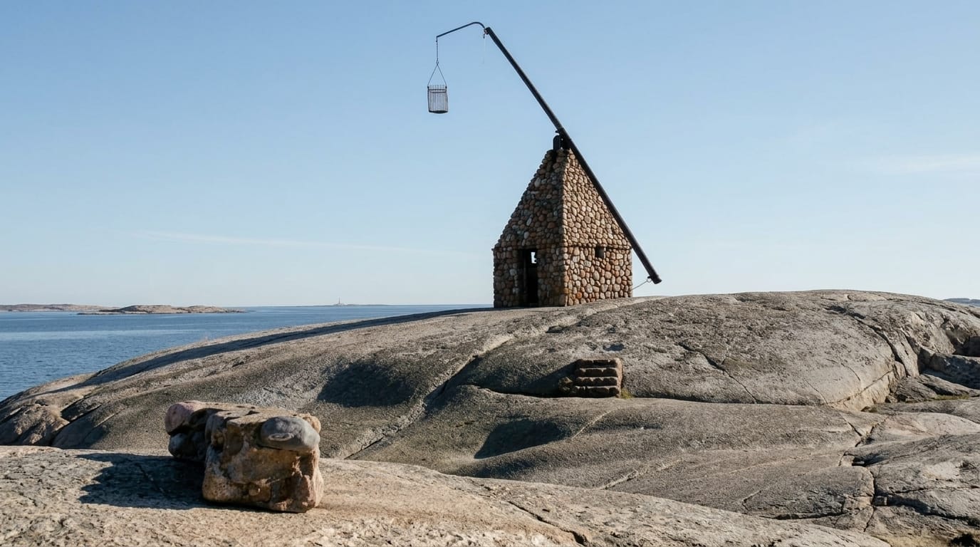
World's End, the rocky tip of Tjome at the mouth of the Oslofjord, with a tipping-lantern beacon of 1932.
Updated 4 September 2026
AI illustration
Verdens Ende is where the road down the Tjome peninsula stops, at a scatter of glacier-worn rock and small islets at the mouth of the Oslofjord, with open water beyond and skerries in every direction. The landmark is a vippefyr, a tipping beacon: a reconstruction built in 1932 of an old form of light in which a fire basket on a long arm is raised and lowered by a counterweight, the way coastal lights worked before lighthouses. Around it are smooth pink rock, bathing spots, a restaurant and the visitor centre for Faerder National Park, which covers the surrounding archipelago. Sunsets over the fjord mouth are the reason most people come in the evening.
The main sights
- The tipping beacon - a 1932 reconstruction of an old fire-basket light.
- The worn rock - smooth glacier-scoured granite at the peninsula's tip.
- The national park centre - the visitor centre for Faerder National Park.
- The open fjord mouth - skerries and water where the Oslofjord meets the sea.
When to go
May to September for swimming, walking and the restaurant; sunset is the classic time. Summer weekends fill the car park by midday. Autumn storms here are dramatic and the site stays open.
What to expect
The site is small, essentially a headland with a beacon, seen in an hour. Parking is charged and fills in summer. The rock is exposed with no shade, and wind off the fjord is common.
Nearby
Faerder National Park's islands lie offshore; Tonsberg and the Vestfold coast are north.
Key facts
Source: Wikidata, item Q1140297, read on 18 October 2026.
What to pack for Verdens Ende
Chosen from what this place is for. Tap a kit for the full checklist.
- Broken-in walking shoes or boots - Grip and ankle support matter more than looks; never hike in brand-new boots. Find on Amazon
- Reef-safe sunscreen - High SPF that will not bleach the coral you are swimming over. Find on Amazon
- Spare batteries + cards - Cold and long shoots drain power; never run out at the good light. Find on Amazon
- Warm base layers - Merino or synthetic against the skin - never cotton, which chills when damp. Find on Amazon
Some links on this page are Amazon affiliate links - if you buy through them we may earn a small commission at no extra cost to you.
All packing kitsPlan your trip
Where to start if Verdens Ende is going on the list.
Booking links on this page are affiliate links - if you book through them we may earn a small commission at no extra cost to you. It never changes what we write about a place.
Opening times, ticket prices and seasonal closures change - check the official source before you go: official site.