Sognsvann
A forest lake at the end of an Oslo metro line, circled by a flat gravel path that the whole city uses.
Updated 4 September 2026
AI illustration
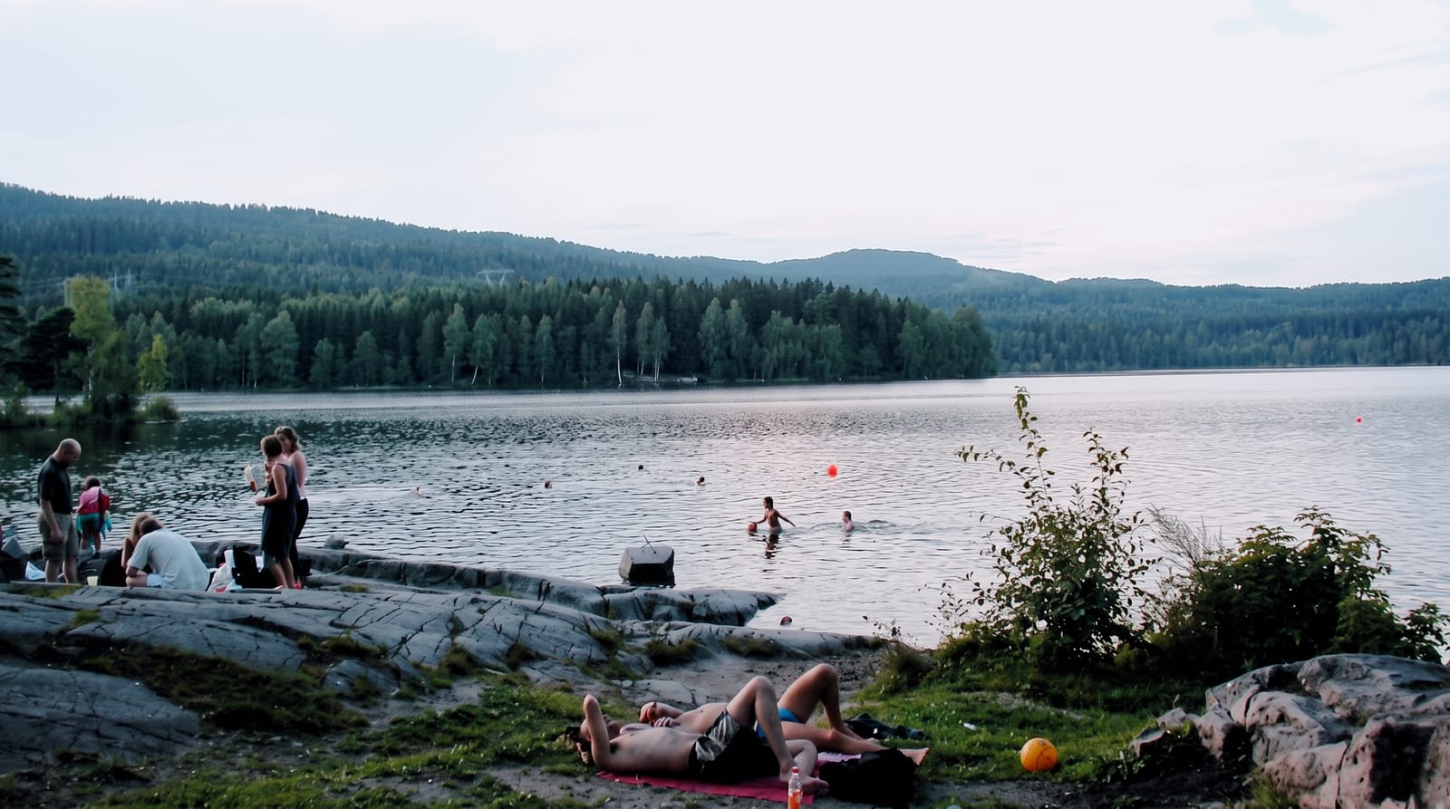
Sognsvann is where Oslo goes to move: a lake of about half a square kilometre at the southern edge of the Nordmarka forest, reached directly by metro, with a 3.3-kilometre gravel loop around it that is flat, wide and lit, used by runners, prams, wheelchairs and walkers at all hours. In summer the shallow northern end and the rocks along the eastern shore fill with swimmers and picnics; the water is clean and cold. In winter the loop is prepared as a ski track and the lake usually freezes hard enough to walk on. From the northern end, trails continue into Nordmarka toward Ullevalseter and the deeper forest, which is how most Oslo residents first enter the woods.
What's there
- The gravel loop - a flat, lit 3.3-kilometre path around the lake.
- The swimming shore - rocks and shallow beaches used all summer.
- The forest edge - trails leading north into Nordmarka.
- The winter track - a prepared ski loop when snow arrives.
When to go
May to September for walking and swimming; the water warms enough for most people from late June. January to March for skiing, when the loop and the forest trails are prepared. Weekends and warm evenings are busy.
What to expect
This is a city recreation area, not wilderness, and on a sunny Sunday the loop is crowded. There are no cafes or restaurants at the lake, only a kiosk in summer, and no swimming supervision. Mosquitoes are noticeable at dusk in midsummer.
Nearby
Nordmarka's trail network starts at the north end; Holmenkollen and the Frognerseteren area lie west.
Key facts
Source: Wikidata, item Q2297840, read on 18 October 2026.
What to pack for Sognsvann
Chosen from what this place is for. Tap a kit for the full checklist.
- Broken-in walking shoes or boots - Grip and ankle support matter more than looks; never hike in brand-new boots. Find on Amazon
- Reef-safe sunscreen - High SPF that will not bleach the coral you are swimming over. Find on Amazon
- Warm base layers - Merino or synthetic against the skin - never cotton, which chills when damp. Find on Amazon
- Layers + a waterproof shell - Mountain weather turns fast; a packable rain jacket saves the day. Find on Amazon
Some links on this page are Amazon affiliate links - if you buy through them we may earn a small commission at no extra cost to you.
All packing kitsPlan your trip
Where to start if Sognsvann is going on the list.
Booking links on this page are affiliate links - if you book through them we may earn a small commission at no extra cost to you. It never changes what we write about a place.
Opening times, ticket prices and seasonal closures change - check the official source before you go: official site.