Hardanger Bridge
A suspension bridge with a 1,310-metre main span crossing the Hardangerfjord, with tunnels at both ends.
Updated 21 October 2026
AI illustration
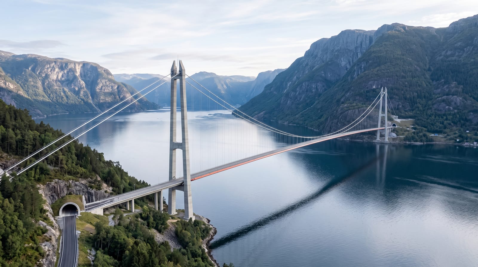
The Hardanger Bridge opened in 2013, replacing a ferry crossing, and its main span of 1,310 metres puts it among the longest suspension bridges in the world and the longest in Norway. What makes it unusual is the approach: the roadway runs straight out of a tunnel at each end, so drivers emerge from rock onto a bridge 55 metres above the water with the fjord opening on both sides and go straight back into rock on the far side. The towers rise about 200 metres. A separate pedestrian and cycle lane runs along the side, and walking across gives the view that drivers barely register. The bridge is tolled and the crossing takes about a minute by car.
History
The Norwegian Parliament approved the bridge on 28 February 2006, construction began on 26 February 2009 with MT Højgaard as builder, and it opened on 17 August 2013, replacing the ferry between Bruravik and Brimnes. It is 1,380 metres long with a main span of 1,310 metres, the longest tunnel-to-tunnel suspension bridge in the world, and its deck height means the largest cruise ships can no longer reach the inner Hardangerfjord (Wikipedia, Hardanger Bridge).
What you'll find
- The 1,310-metre span - one of the world's longest suspension bridges.
- The tunnel-to-tunnel design - road emerging from rock at both ends.
- The pedestrian lane - a walkway giving the view at walking pace.
- The fjord below - the Hardangerfjord 55 metres beneath the deck.
When to go
Year-round; the bridge is open in all seasons and closes only in extreme wind. Walking across is best in clear weather, and the fruit blossom along the Hardanger shores in May makes the surroundings memorable.
Before you go
By car the crossing lasts about a minute and is easy to miss between tunnels. There is no viewpoint on the bridge itself for vehicles, and stopping is not allowed. Tolls apply automatically. Wind on the walkway can be strong.
Nearby
Ulvik and Eidfjord lie east; Norheimsund, Steinsdalsfossen and the Hardanger fruit villages are west.
Key facts
Source: Wikidata, item Q314515, read on 18 October 2026.
What to pack for Hardanger Bridge
Chosen from what this place is for. Tap a kit for the full checklist.
- Comfortable walking shoes - Sightseeing means kilometres of pavement and cobbles daily. Find on Amazon
- A slim anti-theft daypack - Zips that close properly; keep it in front in crowds and on transit. Find on Amazon
- A refillable water bottle - Many cities have public fountains; save money and plastic. Find on Amazon
- A light layer + compact umbrella - For museum air-con and a sudden shower. Find on Amazon
Some links on this page are Amazon affiliate links - if you buy through them we may earn a small commission at no extra cost to you.
All packing kitsPlan your trip
Where to start if Hardanger Bridge is going on the list.
Booking links on this page are affiliate links - if you book through them we may earn a small commission at no extra cost to you. It never changes what we write about a place.
Opening times, ticket prices and seasonal closures change - check the official source before you go: official site.