Poor Knights Islands
Drowned volcanic islands off Northland where a subtropical current brings fish that belong further north.
Updated 21 October 2026
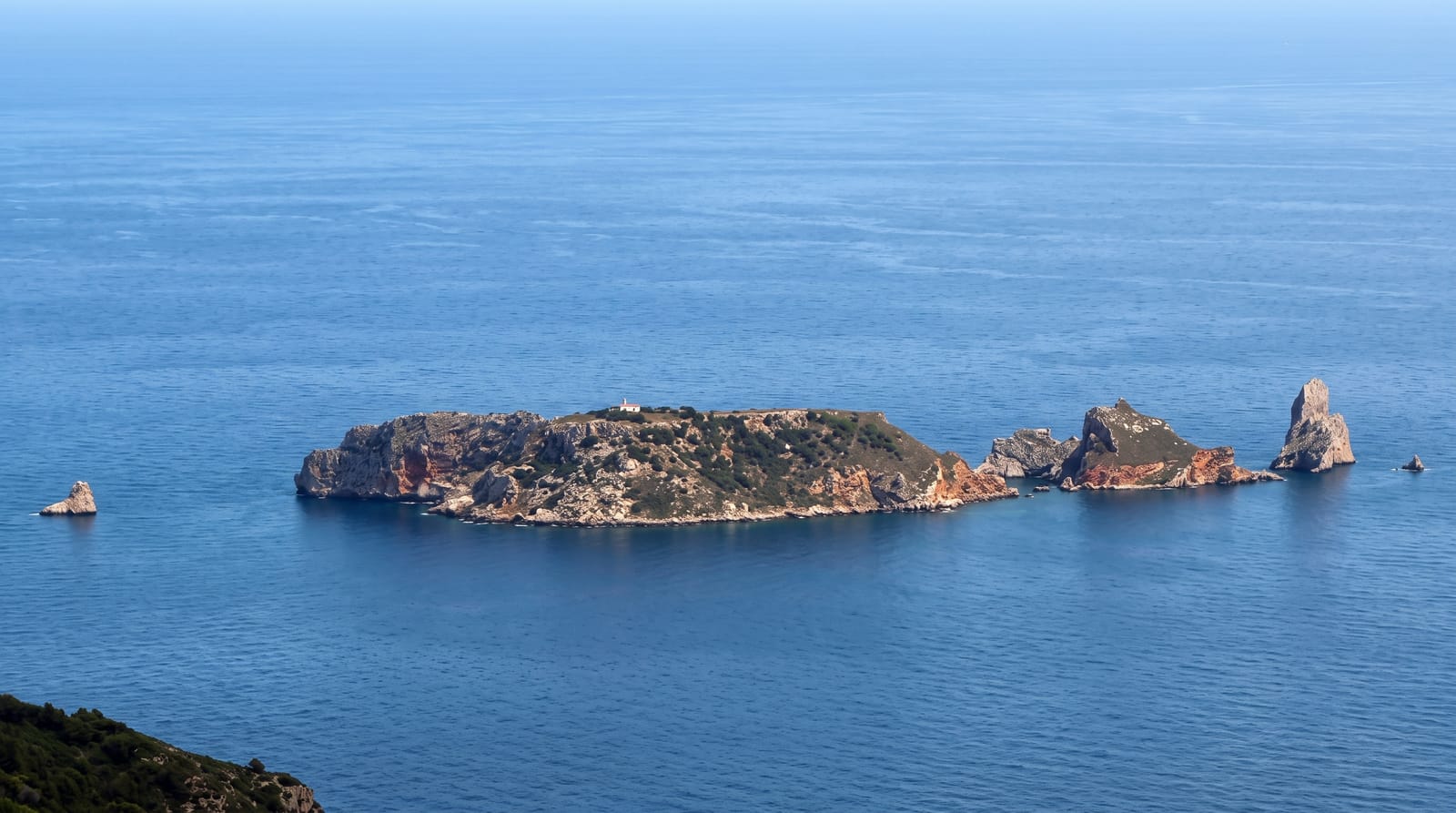
The Poor Knights are the eroded remains of a volcano that erupted about eleven million years ago, sitting twenty-two kilometres off the Tutukaka coast in the path of the East Auckland Current, which carries warm subtropical water south. That current is why the diving here is what it is: species normally found in the tropics turn up alongside temperate ones, the walls drop into deep water covered in sponges and anemones, and the drowned rock is riddled with arches, tunnels and caves - including Rikoriko, one of the largest sea caves in the world by volume. The waters have been a marine reserve since 1981 and fully no-take since 1998. Landing on the islands themselves is not allowed at all: they are a nature reserve holding tuatara, giant weta and seabird colonies, and have been closed since 1981. So this is a boat trip and an in-water experience, weather permitting - and the crossing is often the part that decides the day.
History
The islands were home to Ngāti Wai and Ngāti Toki, who grew crops and fished the surrounding sea, and have been uninhabited since the 1820s. The origin of the English name is unclear: the historian John Beaglehole suggested the Poor Knights of Windsor, or a likeness to Poor Knight's Pudding, a fried bread dish of the time (Wikipedia, Poor Knights Islands).
The landscape
- The subtropical fish - species carried south on the warm current.
- Rikoriko Cave - among the largest sea caves in the world.
- The arches and tunnels - the drowned volcanic rock.
- The walls - sponge and anemone cover dropping into deep water.
When to go
December to May, when the water is warmest and visibility best. Trips are cancelled in swell and wind - build a spare day into any plan built around this.
Good to know
You cannot land on the islands; this is boat and water only. The crossing can be rough and seasickness is common. Diving here needs certification and the deeper sites need experience; snorkel trips are the alternative.
Nearby
Tutukaka is the departure port; Matapouri and the Whangarei Heads are along the coast.
Key facts
Source: Wikidata, item Q628731, read on 18 October 2026.
What to pack for Poor Knights Islands
Chosen from what this place is for. Tap a kit for the full checklist.
- Broken-in walking shoes or boots - Grip and ankle support matter more than looks; never hike in brand-new boots. Find on Amazon
- Your own mask + snorkel - A well-fitting mask is the single biggest comfort upgrade underwater. Find on Amazon
- Head torch + spare batteries - Hands-free light is essential; caves are truly dark. Find on Amazon
- Layers + a waterproof shell - Mountain weather turns fast; a packable rain jacket saves the day. Find on Amazon
Some links on this page are Amazon affiliate links - if you buy through them we may earn a small commission at no extra cost to you.
All packing kitsPlan your trip
Where to start if Poor Knights Islands is going on the list.
Booking links on this page are affiliate links - if you book through them we may earn a small commission at no extra cost to you. It never changes what we write about a place.
Opening times, ticket prices and seasonal closures change - check the official source before you go: official site.