Denniston Incline
The remains of a self-acting coal incline on a bleak West Coast plateau, where loaded wagons hauled empty ones back up as they dropped.
Updated 21 October 2026
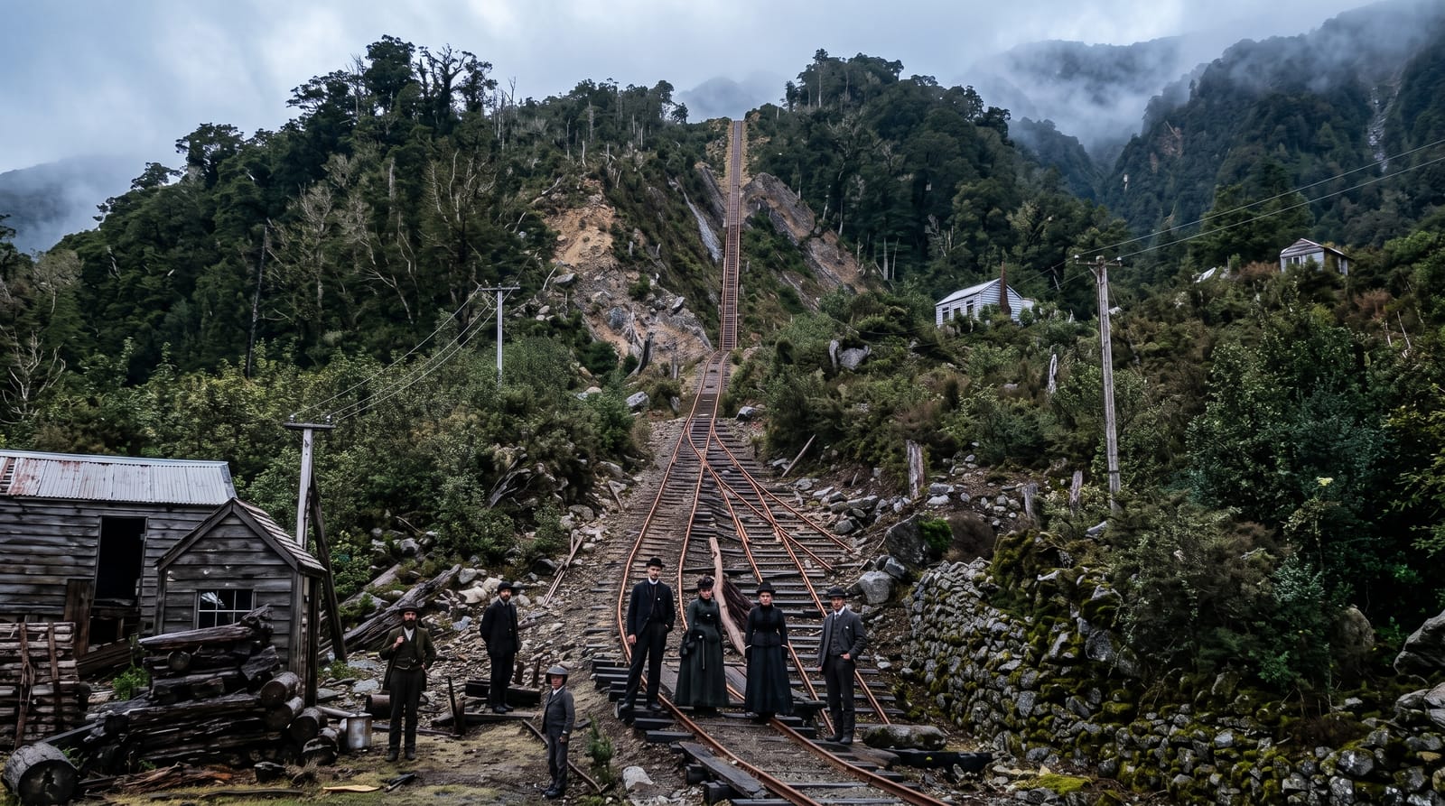
AI illustration
From April 1880 until 1967, coal from the mines on the Denniston plateau went to the valley floor on an incline so steep that it needed no engine: full wagons were let down on ropes and their weight dragged the empties back up. The gradient was severe enough that the system became famous, and the settlement that grew on the plateau to work it had few comforts, sitting high, wet and often inside cloud. What remains is the brake head at the top, sections of rail, concrete and stone foundations, a wagon or two, and the faint street outlines of a town that has gone. Tracks run out across the plateau past further mine sites.
History
The Westport Colliery Company was formed in 1878 to mine the plateau's high-quality coal and built the incline, which began working in April 1880: a self-acting ropeway in which each loaded wagon, lowered on its own rope, hauled an empty one back up. In the early 20th century up to 1,400 people lived on the plateau, and the incline closed on 16 August 1967 (Wikipedia, Denniston, New Zealand).
What's there
- The brake head - the top of the incline, where wagons were coupled and let down the drop.
- The drop itself - the line of the incline falling away to the valley far below.
- Plateau tracks - routes out across the tops past mine mouths and rope roads.
- The town outlines - foundations and street lines of the settlement that worked the mines.
When to go
Summer offers the best odds of a clear day, and clarity is everything here, since in cloud you see perhaps twenty metres and the whole point of the site is the drop. Mornings are more often clear than afternoons. Rain on the plateau is heavy and frequent in any season, so take proper wet weather gear and expect wind on the tops.
Before you go
The weather is both the character of the place and the problem with visiting it: the plateau spends much of the year in cloud and rain, and on a grey day there is very little to see. The road up is narrow with blind corners and steep drops. Facilities are minimal and there is no cafe. The ruins are fragmentary and without the panels much of it reads as rubble.
Nearby
Westport, the seal colony at Cape Foulwind and the Charming Creek walkway are all within an hour.
What to pack for Denniston Incline
Chosen from what this place is for. Tap a kit for the full checklist.
- Comfortable walking shoes - Sightseeing means kilometres of pavement and cobbles daily. Find on Amazon
- A slim anti-theft daypack - Zips that close properly; keep it in front in crowds and on transit. Find on Amazon
- A refillable water bottle - Many cities have public fountains; save money and plastic. Find on Amazon
- A light layer + compact umbrella - For museum air-con and a sudden shower. Find on Amazon
Some links on this page are Amazon affiliate links - if you buy through them we may earn a small commission at no extra cost to you.
All packing kitsPlan your trip
Where to start if Denniston Incline is going on the list.
Booking links on this page are affiliate links - if you book through them we may earn a small commission at no extra cost to you. It never changes what we write about a place.
Opening times, ticket prices and seasonal closures change - check the official source before you go: official site.


