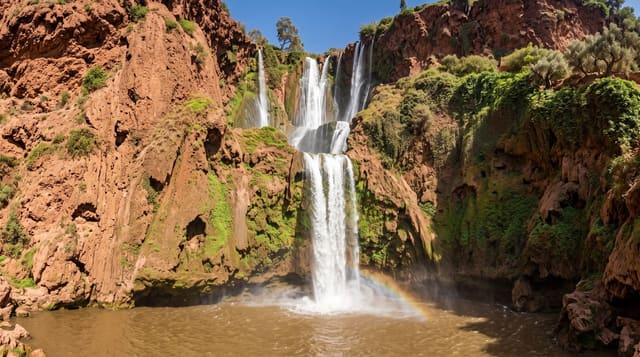
M'Goun Geopark
Africa's first UNESCO Global Geopark, of dinosaur trackways, red canyons and folded strata around Azilal.
Updated 29 August 2026
The M'Goun geopark covers a large area of the Central High Atlas around Azilal and was recognised in 2014 as Africa's first UNESCO Global Geopark. What it protects is the record: this was a shallow sea and then a coastal plain through the Jurassic, and the rock preserves the sequence unusually well - trackways of sauropod and theropod dinosaurs at Iouaridene and elsewhere, marine fossils, and folded and eroded strata that make the structure of the mountains legible from the road. Skeletal material found here includes Atlasaurus, described from a nearly complete specimen from these beds. The Azilal museum holds finds. Around the geological interest sit the things people actually travel for - Ouzoud falls, the Bou Guemez valley, Bin el-Ouidane - and the geopark designation is a frame around them rather than a single site to visit.
The landscape
- Africa's first global geopark - recognised by UNESCO in 2014.
- Dinosaur trackways - sauropod and theropod prints in the Jurassic beds.
- Legible structure - folded and eroded strata visible from the roads.
- A frame, not a site - Ouzoud, Bou Guemez and Bin el-Ouidane all within it.
When to go
Spring and autumn. Two to three days. A guide makes the geology visible.
What to expect
There is no single entrance or centre - it is a designation over a large area. Trackway sites are unmarked and need a guide to find and interpret. Pistes are rough. Interpretation facilities are minimal.
Nearby
Ouzoud falls are west; the Bou Guemez valley is east.
Key facts
Source: Wikidata, item Q104843960, read on 18 October 2026.
What to pack for M'Goun Geopark
Chosen from what this place is for. Tap a kit for the full checklist.
- Broken-in walking shoes or boots - Grip and ankle support matter more than looks; never hike in brand-new boots. Find on Amazon
- Layers + a waterproof shell - Mountain weather turns fast; a packable rain jacket saves the day. Find on Amazon
- Daypack with rain cover - 20-30 litres holds water, snacks, layers and a first-aid kit. Find on Amazon
- Offline maps + a power bank - Download the trail before you lose signal; carry backup charge. Find on Amazon
Some links on this page are Amazon affiliate links - if you buy through them we may earn a small commission at no extra cost to you.
All packing kitsPlan your trip
Where to start if M'Goun Geopark is going on the list.
Booking links on this page are affiliate links - if you book through them we may earn a small commission at no extra cost to you. It never changes what we write about a place.
Opening times, ticket prices and seasonal closures change - check the official source before you go: official site.