Dingli Cliffs
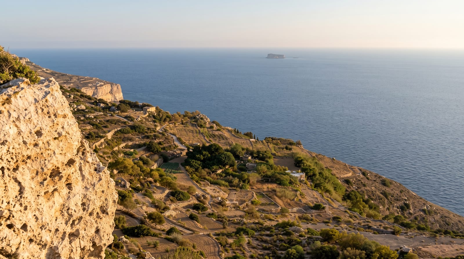
Malta's highest point - limestone cliffs dropping 250 metres to the sea, with terraced fields behind and the islet of Filfla offshore.
Updated 20 October 2026
AI illustration
The western side of Malta rises to a limestone escarpment and simply stops, dropping around 250 metres into the Mediterranean at Dingli - the island's highest ground and its emptiest horizon. A clifftop path runs along the edge past terraced fields, dry-stone walls and the tiny chapel of St Mary Magdalene, with the uninhabited islet of Filfla sitting offshore. Sunset here is the island's classic evening, and because Malta is otherwise so built up, the sense of open space is startling. Nearby, the mysterious Clapham Junction cart ruts - deep parallel grooves cut into bare rock in prehistory - remain unexplained.
History
The name is believed to come from Sir Thomas Dingley, an English knight of the Order of St John who owned much of the land here. Until the early 16th century a small village, Ħal Tartarni, stood between Buskett and the present village, one of Malta's ten original parishes by 1436; its people moved closer to the fields, and the parish of Dingli was established in 1678 (Wikipedia, Dingli).
What's there
- The clifftop path - the walk along the escarpment edge.
- Filfla islet - the uninhabited rock offshore, a bird reserve.
- Clapham Junction cart ruts - prehistoric grooves in the limestone nearby.
- Sunset over the sea - the island's best evening viewpoint.
When to go
Spring brings wildflowers along the cliff path and the greenest terraces; autumn gives warm evenings without summer heat. Summer midday is fierce and shadeless. Winter is windy but dramatic and completely uncrowded.
What to expect
There are no barriers along much of the edge and the rock crumbles in places - keep well back, particularly in wind and with children. Buses reach Dingli village but the cliff path needs a walk from there. Facilities are limited to a couple of cafes. It gets busy at sunset in summer, with parking along the road filling early.
Nearby
Mdina and Rabat, the Blue Grotto to the south and Buskett gardens inland.
What to pack for Dingli Cliffs
Chosen from what this place is for. Tap a kit for the full checklist.
- Broken-in walking shoes or boots - Grip and ankle support matter more than looks; never hike in brand-new boots. Find on Amazon
- Head torch + spare batteries - Hands-free light is essential; caves are truly dark. Find on Amazon
- Spare batteries + cards - Cold and long shoots drain power; never run out at the good light. Find on Amazon
- Layers + a waterproof shell - Mountain weather turns fast; a packable rain jacket saves the day. Find on Amazon
Some links on this page are Amazon affiliate links - if you buy through them we may earn a small commission at no extra cost to you.
All packing kitsPlan your trip
Where to start if Dingli Cliffs is going on the list.
Booking links on this page are affiliate links - if you book through them we may earn a small commission at no extra cost to you. It never changes what we write about a place.
Opening times, ticket prices and seasonal closures change - check the official source before you go: official site.