Pulau Kukup National Park
One of the world's largest uninhabited mangrove islands, a Ramsar site crossed on a boardwalk.
Updated 29 August 2026
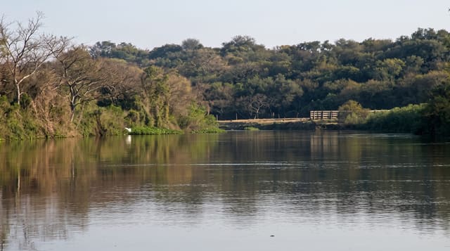
Pulau Kukup lies in the Malacca Strait off the south-western tip of the peninsula and is a solid block of mangrove - about six hundred hectares of it, with no permanent inhabitants and no dry land in the ordinary sense, since the whole island is intertidal mud held together by roots. It was designated a Ramsar wetland in 2003 and gazetted as a national park, and a boardwalk with an observation tower runs into it from the jetty, which is the only practical way to see the interior. What you get is mangrove at close range: pneumatophores standing out of the mud, mudskippers, fiddler crabs waving, monitor lizards, and a good migratory bird count in season. The fishing village of Kukup on the mainland opposite is built on stilts over the water and is the other half of the visit.
What you'll find
- An all-mangrove island - six hundred hectares of intertidal root and mud.
- A boardwalk and tower - the only route into the interior, with a viewpoint.
- Mudskippers and fiddler crabs - the mudflat life at close range.
- Kukup stilt village - the fishing settlement built over the water opposite.
When to go
All year; migratory birds in the northern winter. Half a day.
Practical notes
Mosquitoes and sandflies are severe - cover up. The boardwalk has been closed for repairs at times, so check before crossing. There is no beach and no swimming; this is mud and mangrove.
Nearby
Kukup village and Pontian are on the mainland; Tanjung Piai is south.
What to pack for Pulau Kukup National Park
Chosen from what this place is for. Tap a kit for the full checklist.
- Broken-in walking shoes or boots - Grip and ankle support matter more than looks; never hike in brand-new boots. Find on Amazon
- Travel rod + reel - A packable multi-piece rod fits in a case and covers most holiday fishing. Find on Amazon
- Reef-safe sunscreen - High SPF that will not bleach the coral you are swimming over. Find on Amazon
- Binoculars - The single best wildlife tool - even a compact pair transforms a sighting. Find on Amazon
Some links on this page are Amazon affiliate links - if you buy through them we may earn a small commission at no extra cost to you.
All packing kitsPlan your trip
Where to start if Pulau Kukup National Park is going on the list.
Booking links on this page are affiliate links - if you book through them we may earn a small commission at no extra cost to you. It never changes what we write about a place.
Opening times, ticket prices and seasonal closures change - check the official source before you go: official site.