Lengwe National Park
A small lowland park in the Shire valley, the northern limit of the nyala antelope's range.
Updated 16 October 2026
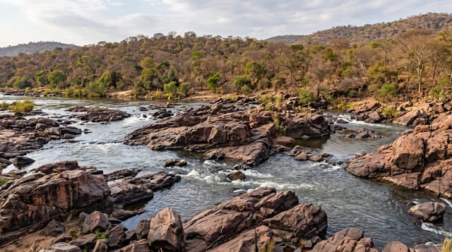
Lengwe sits in the hot lowland of the Shire valley south of Chikwawa, thicket and woodland rather than open savanna, and it was created to protect the northernmost population of nyala, a shy antelope whose range otherwise lies further south. Hides at waterholes are how the game is seen here: buffalo, kudu, bushbuck, warthog and the nyala come to drink through the late dry season when there is nothing else.
Background
Lengwe began in 1928 as a Game Reserve to protect the big mammals of the Lower Shire Valley, the nyala above all. It then measured 520 square kilometres, was later cut to 120 square kilometres to free land for farming, and reached 887 square kilometres when an extension area was added in 1975. National park status came in 1970. Rain is the only reliable water source, and four artificial water holes were built in 1964 and 1970. Besides nyala the park holds giraffe, spotted hyena, leopard, impala, Samango monkey, reedbuck and suni. Birds include the Yellow-spotted nicator, shrikes, rollers and bee-eaters. The park lies near the town of Chikwawa, about 40 miles (64 km) to the southwest of Blantyre.
Source: Wikipedia, "Lengwe National Park"
The landscape
- The nyala - the antelope at the northern limit of its range.
- The waterhole hides - the built points where game is watched at the water.
- The thicket - the dense vegetation that makes game viewing here different.
- The Shire valley setting - the hot lowland the park sits in.
When to go
August to November is the late dry season when game concentrates at the waterholes. The rains disperse everything and make roads difficult. The valley is extremely hot in October and November.
Practical notes
The thicket makes game hard to see away from the hides. Heat in the lower Shire valley regularly exceeds forty degrees late in the dry season. Facilities are basic.
Nearby
Chikwawa is north, and Majete is northwest.
Key facts
Source: Wikidata, item Q1104628, read on 18 October 2026.
What to pack for Lengwe National Park
Chosen from what this place is for. Tap a kit for the full checklist.
- Broken-in walking shoes or boots - Grip and ankle support matter more than looks; never hike in brand-new boots. Find on Amazon
- Binoculars - The single best wildlife tool - even a compact pair transforms a sighting. Find on Amazon
- Layers + a waterproof shell - Mountain weather turns fast; a packable rain jacket saves the day. Find on Amazon
- A zoom camera or long lens - Animals rarely come close; reach beats megapixels. Find on Amazon
Some links on this page are Amazon affiliate links - if you buy through them we may earn a small commission at no extra cost to you.
All packing kitsPlan your trip
Where to start if Lengwe National Park is going on the list.
Booking links on this page are affiliate links - if you book through them we may earn a small commission at no extra cost to you. It never changes what we write about a place.
Opening times, ticket prices and seasonal closures change - check the official source before you go: official site.