Freycinet National Park
A Tasmanian peninsula of pink granite peaks and sheltered bays, best known for the curved white beach of Wineglass Bay.
Updated 4 September 2026
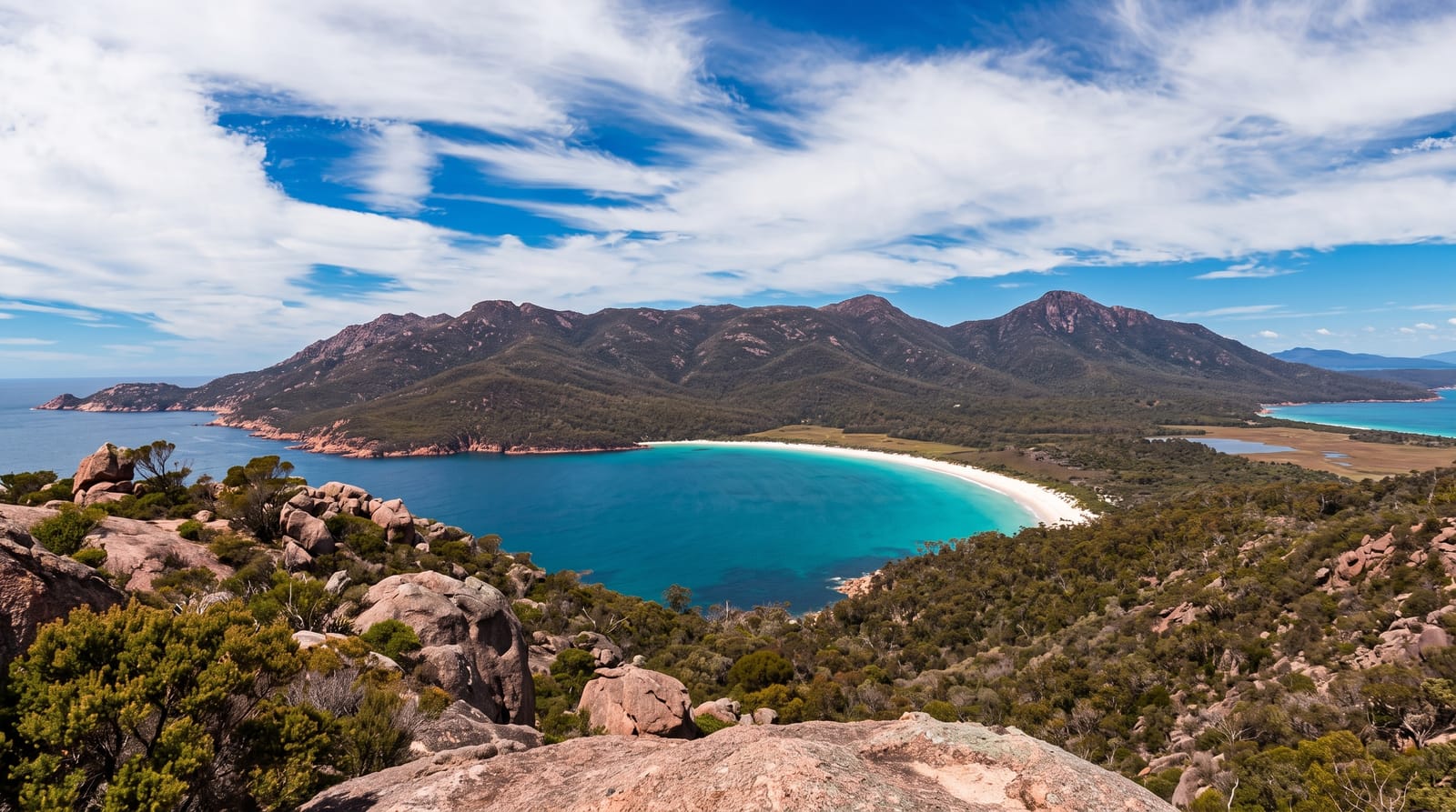
AI illustration
Freycinet occupies a peninsula on Tasmania's east coast where a line of pink granite peaks, the Hazards, rises straight out of the sea. Behind them sits Wineglass Bay, a near-perfect curve of white sand facing east, and the lookout over it is the walk almost everyone does: a steep staircase of about an hour and a half return. Continuing down to the beach itself doubles the effort and thins the crowd considerably. The full circuit crosses the isthmus to Hazards Beach and returns along the coast. Elsewhere on the peninsula, Cape Tourville has an easy boardwalk with open ocean views, and Honeymoon Bay and Sleepy Bay are small granite coves close to the road.
Highlights
- Wineglass Bay Lookout - the standard steep climb to the view over the curved beach.
- The Hazards - pink granite peaks rising directly from the water above Coles Bay.
- Wineglass Bay to Hazards Beach circuit - a longer loop crossing the isthmus and returning along the coast.
- Cape Tourville - a level boardwalk with views along the ocean-facing cliffs.
When to go
November to April is warmest and driest, with January and February the busiest by a wide margin. The lookout is best early, both for light on the bay and for finding a parking space, since the car park regularly fills by mid-morning in summer. Autumn gives stable weather with far fewer people.
What to expect
The lookout climb is a continuous staircase that surprises people expecting a stroll, and the platform gets crowded enough that everyone waits their turn at the rail. The water is cold year-round and swimming is brief. Coles Bay has limited accommodation at high summer prices, and the park car park can turn people away outright in peak season.
Nearby
Bicheno lies north along the coast, with the Bay of Fires further up and Hobart to the south.
Key facts
Source: Wikidata, item Q930677, read on 18 October 2026.
What to pack for Freycinet National Park
Chosen from what this place is for. Tap a kit for the full checklist.
- Broken-in walking shoes or boots - Grip and ankle support matter more than looks; never hike in brand-new boots. Find on Amazon
- Reef-safe sunscreen - High SPF that will not bleach the coral you are swimming over. Find on Amazon
- Binoculars - The single best wildlife tool - even a compact pair transforms a sighting. Find on Amazon
- Layers + a waterproof shell - Mountain weather turns fast; a packable rain jacket saves the day. Find on Amazon
Some links on this page are Amazon affiliate links - if you buy through them we may earn a small commission at no extra cost to you.
All packing kitsPlan your trip
Where to start if Freycinet National Park is going on the list.
Booking links on this page are affiliate links - if you book through them we may earn a small commission at no extra cost to you. It never changes what we write about a place.
Opening times, ticket prices and seasonal closures change - check the official source before you go: official site.