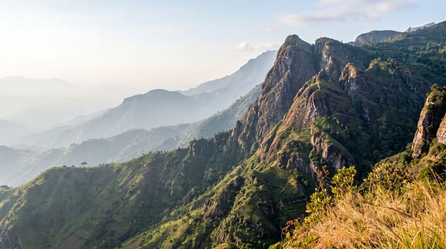
Mount Sannine
A long white limestone ridge above Beirut, snow-capped for much of the year and the city's defining skyline.
Updated 1 September 2026
Sannine is the ridge that fills the horizon behind Beirut, rising to about 2,628 metres, white with snow from December into May and white with bare limestone for the rest of the year. Walking routes go up from Baskinta and from the Zaarour side, crossing high pasture and karst country pitted with sinkholes and small caves. Springs on the flanks feed much of the region's water. The mountain appears constantly in Lebanese poetry and painting, which is part of why people climb it.
What you'll find
- The summit ridge - a long high crest at around 2,628 metres.
- The karst plateau - limestone country pocked with sinkholes and hollows.
- The springs - water sources on the flanks feeding the surrounding valleys.
- The Beirut view - the coast and city laid out below on a clear day.
When to go
June to October is the walking season; snow covers the ridge from December into May. Early starts avoid afternoon cloud. Winter routes need proper equipment and experience.
What to expect
Routes are unmarked and the karst ground is ankle-breaking in places. There is no water on the upper mountain and no shelter. Cloud can close in fast and disorientation is a real risk.
Nearby
Baskinta is below on the western side, and Faqra is north along the range.
Key facts
Source: Wikidata, item Q6923461, read on 18 October 2026.
What to pack for Mount Sannine
Chosen from what this place is for. Tap a kit for the full checklist.
- Broken-in walking shoes or boots - Grip and ankle support matter more than looks; never hike in brand-new boots. Find on Amazon
- Head torch + spare batteries - Hands-free light is essential; caves are truly dark. Find on Amazon
- Warm base layers - Merino or synthetic against the skin - never cotton, which chills when damp. Find on Amazon
- Layers for big temperature swings - Warm sun by day, near-freezing at night, even near the equator. Find on Amazon
Some links on this page are Amazon affiliate links - if you buy through them we may earn a small commission at no extra cost to you.
All packing kitsPlan your trip
Where to start if Mount Sannine is going on the list.
Booking links on this page are affiliate links - if you book through them we may earn a small commission at no extra cost to you. It never changes what we write about a place.
Opening times, ticket prices and seasonal closures change - check the official source before you go: official site.