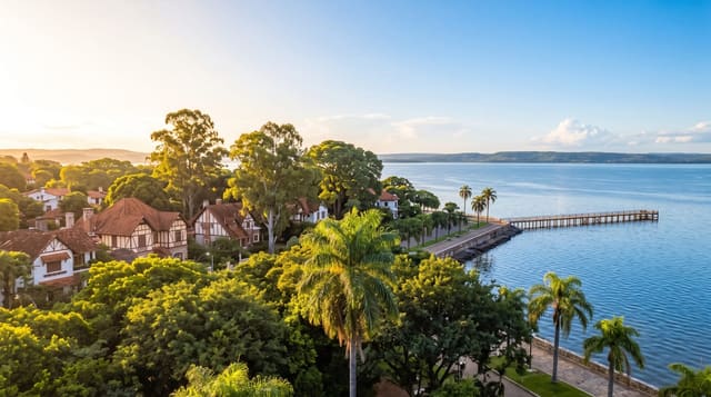
Nam Ngum Reservoir
A large dam lake north of the capital, studded with the tops of drowned hills and worked by fishing boats.
Updated 20 October 2026
The Nam Ngum dam was finished in 1971 and flooded a wide basin of hill country, leaving the summits standing out of the water as a scatter of wooded islands. The lake now supplies much of the country's electricity and a good deal of its freshwater fish, and the shoreline settlements run on both. Boats can be hired at the landings for an afternoon on the water, usually with a stop at a floating restaurant where the fish comes out of the lake in front of you.
History
A feasibility study of December 1962 first set out the Nam Ngum 1 project, and the dam was built in three stages, from 1968 to the completion of the third in 1984 (Wikipedia, Nam Ngum Dam).
What you'll find
- The islands - the tops of drowned hills, wooded and scattered across open water.
- The fishing - net boats and cages, and the catch sold at the landings.
- The floating restaurants - moored platforms serving lake fish, the standard way to spend the middle of the day.
- The dam - the wall itself at the southern end, with the hills behind it.
When to go
November to March is dry and clear, with the calmest water. The lake is highest at the end of the wet season around October and lowest in April, when shorelines widen and stumps appear. Weekends bring boats out from Vientiane.
Practical notes
This is a working reservoir rather than a scenic lake, and parts of the shore are industrial. Boat prices are negotiated and vary a lot depending on the landing. There is little to do on the islands themselves beyond looking at them from the water.
Nearby
Vang Vieng is north up the same road; Vientiane is two hours south.
What to pack for Nam Ngum Reservoir
Chosen from what this place is for. Tap a kit for the full checklist.
- Travel rod + reel - A packable multi-piece rod fits in a case and covers most holiday fishing. Find on Amazon
- Reef-safe sunscreen - High SPF that will not bleach the coral you are swimming over. Find on Amazon
- A small tackle selection - Hooks, weights, line and a few lures or flies suited to local waters. Find on Amazon
- Quick-dry towel - A microfibre towel packs small and dries in minutes. Find on Amazon
Some links on this page are Amazon affiliate links - if you buy through them we may earn a small commission at no extra cost to you.
All packing kitsPlan your trip
Where to start if Nam Ngum Reservoir is going on the list.
Booking links on this page are affiliate links - if you book through them we may earn a small commission at no extra cost to you. It never changes what we write about a place.
Opening times, ticket prices and seasonal closures change - check the official source before you go: official site.