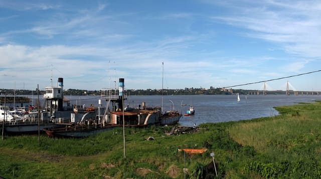
Atyrau
An oil city on the Ural river where a footbridge is marked as the boundary between Europe and Asia.
Updated 20 October 2026
Atyrau sits on the Ural river a short way above its mouth on the Caspian, and the river is conventionally taken as part of the boundary between Europe and Asia, which means the city stands on both: a pedestrian bridge across it is marked with signs at the midpoint, and crossing it is the standard photograph. Founded in the 1640s as a fishing and trading post and called Guryev from 1708 until 1992, it became the centre of Kazakhstan's oil industry, and the Tengiz and Kashagan fields drive the local economy and give the city a large expatriate population and prices to match. The Imangali mosque, the regional museum and the riverbank are the sights. Sturgeon and caviar were historically the other business of the Ural mouth.
History
The trader Gury Nazarov founded a wooden fort at the mouth of the Yaik in 1645, which the Guryev family rebuilt in stone from 1647 to 1662, and the town was called Guryev from 1708. Oil was found on the Emba River in 1892, and the city's first refinery opened in 1945 (Wikipedia, Atyrau).
The main sights
- The Europe-Asia bridge - the footbridge marked at the continental boundary.
- The Ural river - the water running through the middle of the city.
- Imangali mosque - the main mosque on the European bank.
- The regional museum - the Caspian and Ural collections.
When to go
May to June and September to October; summer is very hot and winter severely cold with wind off the steppe. The city is a working oil centre and busy year round. Nauryz in March fills the parks.
Practical notes
This is an industrial oil city with limited sightseeing. Prices, particularly for hotels, are high because of the oil sector. Air quality and industrial haze can be poor. The Europe-Asia crossing is a signpost rather than a monument.
Nearby
Saraishyk lies upriver; the Caspian is south.
Key facts
Source: Wikidata, item Q486913, read on 18 October 2026.
What to pack for Atyrau
Chosen from what this place is for. Tap a kit for the full checklist.
- Travel rod + reel - A packable multi-piece rod fits in a case and covers most holiday fishing. Find on Amazon
- Comfortable walking shoes - Sightseeing means kilometres of pavement and cobbles daily. Find on Amazon
- Modest clothing - Shoulders and knees covered - the single most common requirement. Find on Amazon
- A small tackle selection - Hooks, weights, line and a few lures or flies suited to local waters. Find on Amazon
Some links on this page are Amazon affiliate links - if you buy through them we may earn a small commission at no extra cost to you.
All packing kitsPlan your trip
Where to start if Atyrau is going on the list.
Booking links on this page are affiliate links - if you book through them we may earn a small commission at no extra cost to you. It never changes what we write about a place.
Opening times, ticket prices and seasonal closures change - check the official source before you go: official site.