Oki Islands
Four inhabited islands of sea cliffs and caldera rim, where cattle and horses graze loose on the clifftops.
Updated 20 October 2026
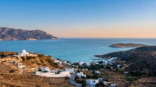
The Oki islands sit about fifty kilometres off the Shimane coast and are a UNESCO Global Geopark: three of them, the Dozen group, are the rim of a drowned caldera, and the fourth, Dogo, is a larger volcanic island. The Matengai cliff on Nishinoshima rises about 257 metres straight from the sea, and the ground above it is open grassland where cattle and horses graze unfenced right to the edge - walking among them along the cliff top is the single best thing here. Isolation has produced its own flora, with northern and southern species growing together, and its own culture: bull sumo, in which two bulls push against each other, and a form of kagura performance. The islands were a place of exile for two emperors in the medieval period, which is recorded at shrines on Dogo. Ferries are slow and weather-dependent.
History
The islands have been lived on since the Japanese Palaeolithic and became Oki Province under the Ritsuryō reforms of the late 7th century. From the late Heian period their remoteness made them a place of exile: Emperor Go-Toba was sent here in 1221 and died on the islands, and Emperor Go-Daigo, sent here in 1332, escaped (Wikipedia, Oki Islands).
What you'll find
- Matengai - a cliff of about 257 metres with grazing land running to the edge.
- A drowned caldera - three islands forming the rim, one larger volcanic island.
- Loose cattle and horses - grazing unfenced on the clifftop grassland.
- A UNESCO Global Geopark - with its own mixed northern and southern flora.
When to go
May to October. Three days, allowing for ferry timetables.
What to expect
Ferries take two to three hours and are cancelled in swell, which can strand visitors. Inter-island connections are infrequent and dictate the itinerary. Accommodation is limited and mostly minshuku. Winter services are much reduced.
Nearby
Matsue and Izumo Taisha are on the mainland to the south.
Key facts
Source: Wikidata, item Q483146, read on 18 October 2026.
What to pack for Oki Islands
Chosen from what this place is for. Tap a kit for the full checklist.
- Reef-safe sunscreen - High SPF that will not bleach the coral you are swimming over. Find on Amazon
- Modest clothing - Shoulders and knees covered - the single most common requirement. Find on Amazon
- Quick-dry towel - A microfibre towel packs small and dries in minutes. Find on Amazon
- A scarf or shawl - To cover the head or shoulders on entry; women especially at mosques. Find on Amazon
Some links on this page are Amazon affiliate links - if you buy through them we may earn a small commission at no extra cost to you.
All packing kitsPlan your trip
Where to start if Oki Islands is going on the list.
Booking links on this page are affiliate links - if you book through them we may earn a small commission at no extra cost to you. It never changes what we write about a place.
Opening times, ticket prices and seasonal closures change - check the official source before you go: official site.