Mount Daisen
A volcano with a Fuji-shaped western face and a collapsed eastern one, wrapped in the country's largest beech forest.
Updated 20 October 2026
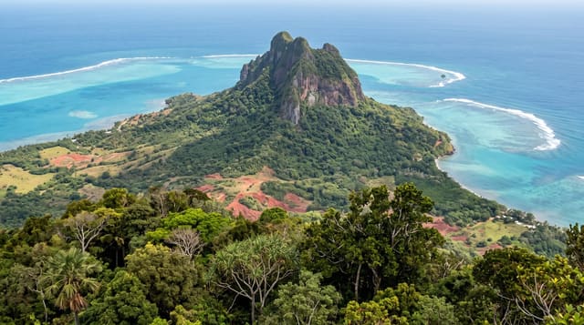
Daisen is 1,729 metres and the highest mountain in the Chugoku region. Seen from the west it is a clean cone and is called Hoki Fuji; seen from the south and east it is a jagged ridge, because that side has collapsed and continues to erode, and the true summit, Kengamine, has been closed to walkers for years as the ridge to it is unstable. The permitted summit is Misen at 1,709 metres, about three hours up a stepped trail from Daisen-ji. The forest on the lower slopes is the largest stand of Japanese beech in the country and turns in late October. Daisen-ji itself was a major mountain temple complex from the eighth century, with a shrine, Ogamiyama, above it approached along a stone-paved avenue under cedars. In winter the mountain carries the best snow in western Japan.
History
Standing directly on the Sea of Japan, Daisen was one of the most important mountains for Shugendō. The Izumo Kokudo Fudoki, completed in 733, calls it Ōgami-take, "mountain of the great god", and the temple Daisen-ji halfway up has been a centre of worship since the Heian period (Wikipedia, Mount Daisen).
The landscape
- Two faces - a Fuji cone from the west, a collapsed ridge from the east.
- The largest beech forest in Japan - turning in late October on the lower slopes.
- Daisen-ji and Ogamiyama - an eighth-century mountain temple and its cedar avenue.
- A three-hour climb - stepped trail to Misen, the permitted summit.
When to go
June to October for walking; late October for beech colour. A day.
Things to know
The true summit is closed and has been for years - the walk ends at Misen. The trail is almost entirely steps and hard on the knees. Weather changes fast and the upper mountain is exposed. Winter access needs proper equipment.
Nearby
Yonago and the Sea of Japan coast are north; Matsue is west.
Key facts
Source: Wikidata, item Q715498, read on 18 October 2026.
What to pack for Mount Daisen
Chosen from what this place is for. Tap a kit for the full checklist.
- Broken-in walking shoes or boots - Grip and ankle support matter more than looks; never hike in brand-new boots. Find on Amazon
- Warm base layers - Merino or synthetic against the skin - never cotton, which chills when damp. Find on Amazon
- Layers for big temperature swings - Warm sun by day, near-freezing at night, even near the equator. Find on Amazon
- Modest clothing - Shoulders and knees covered - the single most common requirement. Find on Amazon
Some links on this page are Amazon affiliate links - if you buy through them we may earn a small commission at no extra cost to you.
All packing kitsPlan your trip
Where to start if Mount Daisen is going on the list.
Booking links on this page are affiliate links - if you book through them we may earn a small commission at no extra cost to you. It never changes what we write about a place.
Opening times, ticket prices and seasonal closures change - check the official source before you go: official site.