Lake Shikotsu
Japan's second-deepest lake, too deep to freeze, with an ice festival built from its own sprayed water.
Updated 20 October 2026
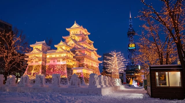
Shikotsu is a caldera lake of about 360 metres depth, the second deepest in Japan after Tazawa, and that volume of water holds enough heat that the surface has never frozen over in recorded observation despite Hokkaido winters - the lake steams instead. The water is also among the clearest in the country, repeatedly rated top for quality, and on a still day the bottom is visible far out from shore. Three volcanoes stand around it: Eniwa to the north, Fuppushi and Tarumae to the south, the last with a bare lava dome that can be walked up in about an hour from the trailhead. In winter the Hyoto Matsuri, the ice festival, sprays lake water over frames until it builds into blue translucent structures which are lit at night. Canoeing and diving in the clear water are the summer draws.
History
The name comes from the Ainu shikot, "big hollow"; to Japanese ears it sounded like "dead bones", and an attempt to rename the lake engi did not last (Wikipedia, Lake Shikotsu).
The landscape
- A lake that will not freeze - too deep and too warm at depth, steaming in winter.
- Exceptional clarity - among the clearest water in Japan, bottom visible offshore.
- Three volcanoes - Eniwa, Fuppushi and the bare dome of Tarumae.
- The ice festival - structures built from sprayed lake water and lit at night.
When to go
June to October for the water; late January to mid-February for the ice festival. A day.
Practical notes
The shore is largely undeveloped, which means limited food and facilities. Winter access depends on road conditions. Tarumae's trail closes for volcanic activity. Summer weekends fill the small car parks early.
Nearby
Lake Toya is south-west; Sapporo is north.
Key facts
Source: Wikidata, item Q1196295, read on 18 October 2026.
What to pack for Lake Shikotsu
Chosen from what this place is for. Tap a kit for the full checklist.
- Broken-in walking shoes or boots - Grip and ankle support matter more than looks; never hike in brand-new boots. Find on Amazon
- Your own mask + snorkel - A well-fitting mask is the single biggest comfort upgrade underwater. Find on Amazon
- Quick-dry clothing - Board shorts or synthetics that shrug off spray and dry fast. Find on Amazon
- Layers + a waterproof shell - Mountain weather turns fast; a packable rain jacket saves the day. Find on Amazon
Some links on this page are Amazon affiliate links - if you buy through them we may earn a small commission at no extra cost to you.
All packing kitsPlan your trip
Where to start if Lake Shikotsu is going on the list.
Booking links on this page are affiliate links - if you book through them we may earn a small commission at no extra cost to you. It never changes what we write about a place.
Opening times, ticket prices and seasonal closures change - check the official source before you go: official site.