Kouri Island
A small round island reached by a two-kilometre bridge that runs low and straight over turquoise shallows.
Updated 29 August 2026
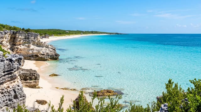
Kouri is about eight kilometres around and is reached by a bridge of just under two kilometres, opened in 2005, which runs low and dead straight over water shallow enough to be a flat pale turquoise on either side - driving it is the reason most people come, and there is a car park at the island end for the walk back along it. The island itself has a beach either side of the bridgehead, a small village, sugar cane fields and a shrine. On the northern shore are the Heart Rocks, two eroded stacks that from one angle overlap into a heart shape; they were used in an advertisement and now have a paid car park, a path and a queue. Local legend calls Kouri the island where the first man and woman of Okinawa lived, which is why it is sometimes called the island of love, a connection the Heart Rocks marketing leans on heavily.
What you'll find
- The bridge - just under two kilometres, low and straight over pale turquoise shallows.
- Beaches at the bridgehead - shallow clear water on both sides of the causeway.
- Heart Rocks - two stacks overlapping into a heart from one particular angle.
- A small island - eight kilometres around, with cane fields and a village.
When to go
April to October. Half a day. Midday sun for the strongest water colour.
What to expect
Heart Rocks has a paid car park, a queue and works only from one spot - many find it underwhelming. The island is small and there is little beyond the bridge and the beaches. A car is essential. Typhoons close the bridge.
Nearby
Churaumi Aquarium is on the Motobu peninsula; Nakijin Castle is close.
Key facts
Source: Wikidata, item Q4518163, read on 18 October 2026.
What to pack for Kouri Island
Chosen from what this place is for. Tap a kit for the full checklist.
- Reef-safe sunscreen - High SPF that will not bleach the coral you are swimming over. Find on Amazon
- Modest clothing - Shoulders and knees covered - the single most common requirement. Find on Amazon
- Quick-dry towel - A microfibre towel packs small and dries in minutes. Find on Amazon
- A scarf or shawl - To cover the head or shoulders on entry; women especially at mosques. Find on Amazon
Some links on this page are Amazon affiliate links - if you buy through them we may earn a small commission at no extra cost to you.
All packing kitsPlan your trip
Where to start if Kouri Island is going on the list.
Booking links on this page are affiliate links - if you book through them we may earn a small commission at no extra cost to you. It never changes what we write about a place.
Opening times, ticket prices and seasonal closures change - check the official source before you go: official site.