Pantalica
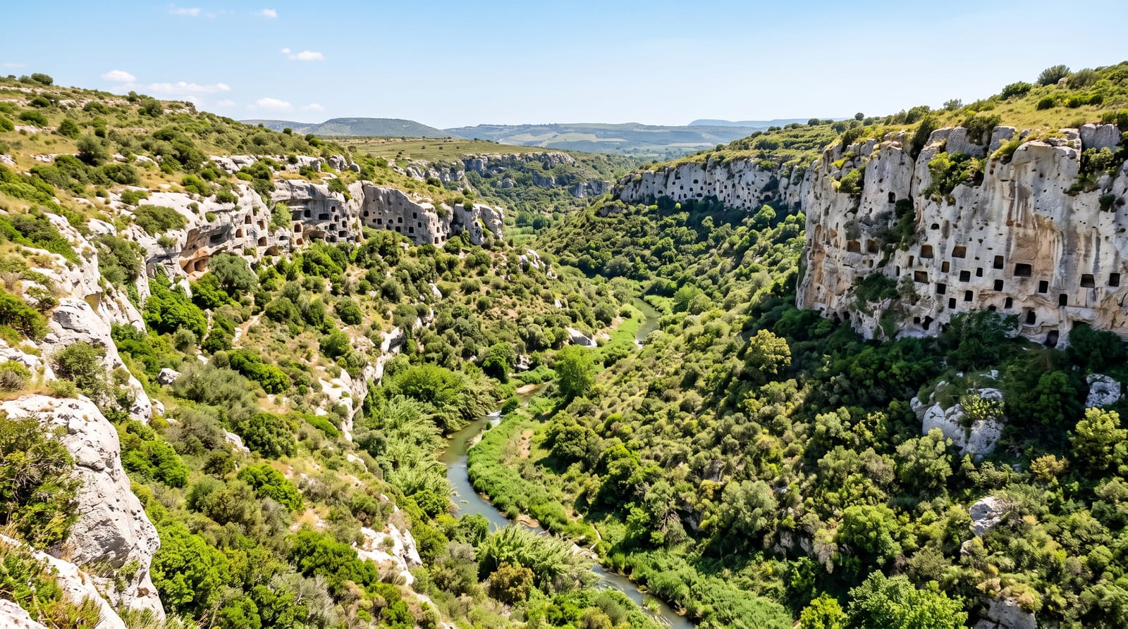
Nearly four thousand tombs cut into the walls of a river canyon between the thirteenth and seventh centuries BC.
Updated 16 October 2026
AI illustration
UNESCO World Heritage
Two rivers cut deep limestone gorges here, and into their walls people carved just under four thousand chamber tombs, by the latest count, over six centuries from about 1250 BC, producing a cliff face pocked with openings on every level. The site is associated with the Sicel population before Greek colonisation, and a structure on the plateau called the Anaktoron may have been a chief's building. Later, Byzantine communities reused tombs as dwellings and cut small rock chapels. UNESCO listed Pantalica with Syracuse in 2005. Paths descend into the gorge to river pools, and the canyon holds its own vegetation and birdlife.
Background
The cemeteries wrap around a large promontory where the Calcinara joins the Anapo, about 23 kilometres northwest of Syracuse. Older counts gave over 5,000 tombs, but the most recent estimate is just under 4,000, spread across five cemeteries, of which Filiporto alone has almost 1000. The settlement flourished from about 1250 to 650 BC, and some archaeologists link it with Hybla, named after a Sicel king Hyblon recorded by Thucydides. Material from the 4th and 3rd centuries BC shows later use, and three small rock-cut chapels keep faint traces of frescoes. Paolo Orsi excavated mainly between 1895 and 1910, after most tombs had been looted. A railway along the valley floor, dismantled in 1956, now serves as a path.
Source: Wikipedia, "Necropolis of Pantalica"
Highlights
- The tomb faces - thousands of chamber openings cut into gorge walls.
- The Anaktoron - a stone structure on the plateau above.
- The Byzantine reuse - tombs turned into dwellings and rock chapels.
- The river pools - swimming spots on the gorge floor.
When to go
April to June and September to October; summer in the gorge is very hot. Paths down are steep and long. Access roads from Sortino and Ferla reach different sections.
Practical notes
There are no facilities, signage is thin and the descents are steep with a hard climb back. Tombs are viewed from paths and mostly empty. Bring water.
Nearby
Syracuse lies southeast; the Iblei hills surround it.
Key facts
Source: Wikidata, item Q931434, read on 18 October 2026.
What to pack for Pantalica
Chosen from what this place is for. Tap a kit for the full checklist.
- Reef-safe sunscreen - High SPF that will not bleach the coral you are swimming over. Find on Amazon
- Binoculars - The single best wildlife tool - even a compact pair transforms a sighting. Find on Amazon
- Comfortable walking shoes - Sightseeing means kilometres of pavement and cobbles daily. Find on Amazon
- Quick-dry towel - A microfibre towel packs small and dries in minutes. Find on Amazon
Some links on this page are Amazon affiliate links - if you buy through them we may earn a small commission at no extra cost to you.
All packing kitsPlan your trip
Where to start if Pantalica is going on the list.
Booking links on this page are affiliate links - if you book through them we may earn a small commission at no extra cost to you. It never changes what we write about a place.
Opening times, ticket prices and seasonal closures change - check the official source before you go: official site.