Charles Fort
A vast seventeenth-century star fort above Kinsale harbour, whose landward side was its known weakness from the day it opened.
Updated 19 October 2026
Charles Fort was begun in 1677 to designs by William Robinson, in the star-shaped bastioned style developed in Europe to resist artillery, and it is among the largest military installations of its period in Ireland. Its purpose was to command the harbour mouth, and against ships it was formidable. The weakness was recognised at the time and criticised by contemporaries: the ground rises behind it, so guns on the high land could fire down into the fort. That is exactly what happened in 1690, when Williamite forces under Marlborough took it in thirteen days by bombarding from above. It remained a British garrison until 1922, was burned during the Civil War, and has been conserved since the 1970s. The site is large - bastions, barracks, magazines and officers' quarters - with a coastal walk from Kinsale along the water, and guided tours run in season.
History
The fort, named after Charles II, was built between 1677 and 1682 to a design by the Surveyor-general Sir William Robinson, on the ruins of Barry Óg Castle at Rincurran, whose defences had featured in the Siege of Kinsale in 1601. An early lighthouse was set up here in the 17th century by Robert Reading, and further works were added through the 18th and 19th centuries (Wikipedia, Charles Fort (Ireland)).
What's there
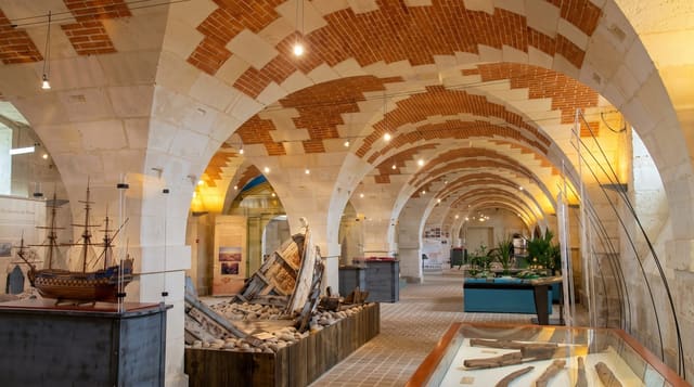
- The star plan - bastions and ramparts in the seventeenth-century artillery style.
- The barracks and quarters - the garrison buildings inside the walls.
- The harbour command - the position controlling the mouth at Kinsale.
- The high ground behind - the flaw that lost it in 1690.
When to go
April to October for the guided tours and the coastal walk from Kinsale, which takes about an hour each way. Reduced opening in winter. Two hours for the fort itself.
Good to know
Large and exposed, with a lot of walking on uneven ramparts and open drops in places. Many buildings are roofless shells. Ticketed. Wind off the harbour is constant.
Nearby
Kinsale town is west; James Fort faces it across the harbour mouth.
Key facts
Source: Wikidata, item Q1064401, read on 18 October 2026.
What to pack for Charles Fort
Chosen from what this place is for. Tap a kit for the full checklist.
- Comfortable walking shoes - Sightseeing means kilometres of pavement and cobbles daily. Find on Amazon
- A slim anti-theft daypack - Zips that close properly; keep it in front in crowds and on transit. Find on Amazon
- A refillable water bottle - Many cities have public fountains; save money and plastic. Find on Amazon
- A light layer + compact umbrella - For museum air-con and a sudden shower. Find on Amazon
Some links on this page are Amazon affiliate links - if you buy through them we may earn a small commission at no extra cost to you.
All packing kitsPlan your trip
Where to start if Charles Fort is going on the list.
Booking links on this page are affiliate links - if you book through them we may earn a small commission at no extra cost to you. It never changes what we write about a place.
Opening times, ticket prices and seasonal closures change - check the official source before you go: official site.