Nusa Penida
A dry limestone island off southeast Bali with high sea cliffs, hidden coves and manta rays at a fixed dive site.
Updated 19 October 2026

AI illustration
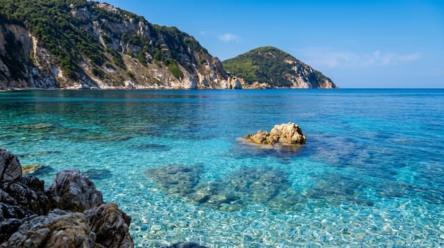
Nusa Penida lies across a strait from southeast Bali and looks nothing like it: dry, hilly limestone country with almost no rice, and a coast of cliffs dropping straight into blue water. The famous view is Kelingking, where a spur of rock runs out to sea above a beach almost nobody reaches. Elsewhere there is Angel's Billabong, a tidal pool cut into the rock shelf, Broken Beach with its natural arch, and Diamond and Atuh beaches on the east side. Underwater the island is the reason many people dive Bali at all, with cleaning stations where reef mantas gather and, in the cold months, the occasional oceanic sunfish.
History
The name means "island of priests" in Balinese. The earliest writing about the island is on the Belanjong pillar of 914 AD, which records an expedition by the first Balinese king, Sri Kesari Warmadewa, to take it; its people long held out against the Balinese kings, until the Gelgel dynasty took the island in the second half of the 17th century (Wikipedia, Nusa Penida).
What's there
- Kelingking - the headland viewpoint above a long beach, reached by a steep bamboo stair.
- Angel's Billabong and Broken Beach - a tidal rock pool and a collapsed sea arch on the west coast.
- Manta Point - the cleaning station on the south coast where reef mantas circle.
- Diamond Beach - a cove on the east side below carved cliff steps.
When to go
April to October brings calmer crossings and better visibility underwater; the strait can be rough and boats are cancelled in bad weather. Sunfish appear mainly between July and October in cold upwelling water, which is also when the currents are strongest. Stay overnight rather than doing a day trip, which wastes most of the day on boats.
Before you go
The island's roads are narrow, steep and in poor condition, and scooter accidents are common among visitors who have not ridden before. Kelingking is now a queue for the same photograph, with a car park to match. Diving here means strong, cold currents and is not for beginners. Water and waste infrastructure has not kept up with the number of arrivals.
Nearby
Nusa Lembongan and Nusa Ceningan are a short boat hop north.
Key facts
Source: Wikidata, item Q1520301, read on 18 October 2026.
What to pack for Nusa Penida
Chosen from what this place is for. Tap a kit for the full checklist.
- Reef-safe sunscreen - High SPF that will not bleach the coral you are swimming over. Find on Amazon
- Your own mask + snorkel - A well-fitting mask is the single biggest comfort upgrade underwater. Find on Amazon
- Binoculars - The single best wildlife tool - even a compact pair transforms a sighting. Find on Amazon
- Shelter suited to the place - Tent, tarp or hut booking - match it to the terrain and rules. Find on Amazon
Some links on this page are Amazon affiliate links - if you buy through them we may earn a small commission at no extra cost to you.
All packing kitsPlan your trip
Where to start if Nusa Penida is going on the list.
Booking links on this page are affiliate links - if you book through them we may earn a small commission at no extra cost to you. It never changes what we write about a place.
Opening times, ticket prices and seasonal closures change - check the official source before you go: official site.