Mount Rinjani
Indonesia's second-highest volcano, on Lombok, a demanding multi-day trek to a crater rim above a crescent lake with a smoking cone rising from it.
Updated 29 August 2026
AI illustration
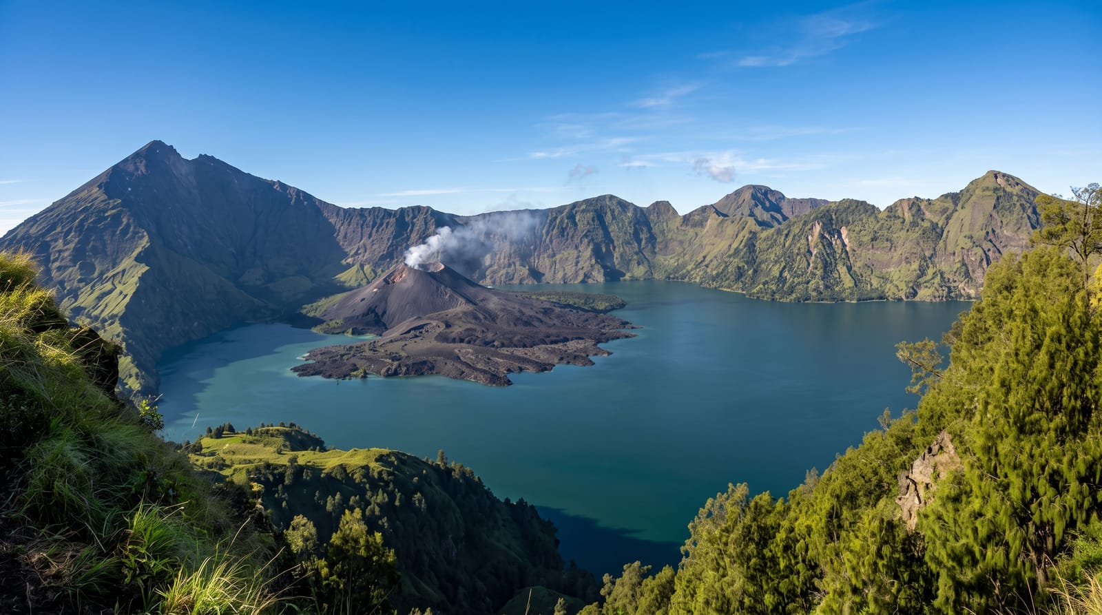
Mount Rinjani rises to 3,726 metres on the island of Lombok, the second-highest volcano in Indonesia, and its summit trek is one of the great walks of Southeast Asia. The reward at the crater rim is extraordinary: a vast caldera holding the crescent lake of Segara Anak, a deep blue-green sheet of water from which a new active cone, Gunung Baru, has grown and still smokes. Hot springs bubble at the lake's edge, and the climb to the true summit, usually tackled before dawn on loose volcanic scree, delivers a sunrise over Lombok, Bali and the sea. The mountain is sacred to the Sasak and Balinese, who make pilgrimages to the lake. It is a serious undertaking, cold, steep and long, almost always done over two or three days with a guide and porters, and it is closed in the wet season.
What's there
- The crater rim - the first view down to Segara Anak lake and the caldera.
- Segara Anak and Gunung Baru - the crescent lake and the smoking new cone within it.
- The summit sunrise - the pre-dawn scramble up scree for the view over three islands.
- The hot springs - the warm pools at the lake's edge, a reward on the trek.
When to go
April to November is the dry season and the only time the mountain is open; it closes during the rains, roughly December to March, and around Nyepi. Even in the dry season the summit night is bitterly cold. The trek is timed so the summit push starts hours before dawn.
What to expect
This is a genuinely hard, cold, multi-day mountain trek, not a day hike: the summit scree is exhausting, altitude can affect people, and nights on the rim are freezing, so fitness and proper gear matter. It must be done with a licensed guide and porters, and choosing a reputable operator affects both safety and the porters' welfare. The mountain closes entirely in the wet season and can shut at short notice for volcanic activity.
Nearby
The Gili Islands and the beaches of Lombok are reached from the same coast; Bali is a short flight or ferry away.
Key facts
Source: Wikidata, item Q847323, read on 18 October 2026.
What to pack for Mount Rinjani
Chosen from what this place is for. Tap a kit for the full checklist.
- Broken-in walking shoes or boots - Grip and ankle support matter more than looks; never hike in brand-new boots. Find on Amazon
- Reef-safe sunscreen - High SPF that will not bleach the coral you are swimming over. Find on Amazon
- Layers for big temperature swings - Warm sun by day, near-freezing at night, even near the equator. Find on Amazon
- Modest clothing - Shoulders and knees covered - the single most common requirement. Find on Amazon
Some links on this page are Amazon affiliate links - if you buy through them we may earn a small commission at no extra cost to you.
All packing kitsPlan your trip
Where to start if Mount Rinjani is going on the list.
Booking links on this page are affiliate links - if you book through them we may earn a small commission at no extra cost to you. It never changes what we write about a place.
Opening times, ticket prices and seasonal closures change - check the official source before you go: official site.