Mechuka
A wide valley near the Tibetan border, with a river across the floor and a four-hundred-year-old monastery above.
Updated 19 October 2026
AI illustration
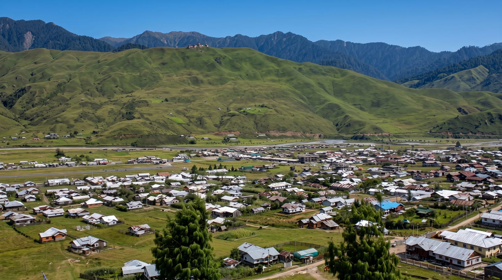
Mechuka lies at about 1,830 metres in a broad flat-floored valley near the Tibetan border, with the Yargyap Chu running across it and pine-covered ridges on both sides, which makes it unusually open for Arunachal, where most valleys are narrow and forested. The Samten Yongcha monastery on a spur above the village belongs to the Mahayana tradition and is said to be around four hundred years old. The Memba are the main community, culturally close to Tibetan groups across the border. The road in from Aalo is long and rough, and the valley remained effectively closed to visitors until relatively recently.
History
Before the 1950s the valley was known as Pachakshiri, and the name Menchukha is said to mean "medicinal water of snow" in the local language. Before the modern road was built the only access was by an airstrip used by the Indian Air Force to bring in supplies, and the Memba people traded with Tibet, exchanging mithun for salt and medicines, with horses as their main transport (Wikipedia, Mechuka).
What you'll find
- The open valley - a broad flat floor with the river across it.
- Samten Yongcha - a monastery of around four hundred years on the ridge.
- The Memba villages - communities culturally linked across the border.
- The pine ridges - forested slopes enclosing the valley.
When to go
October to April for clear weather; the monsoon brings landslides that close the road for days. Winter is cold with occasional snow. The drive from Aalo takes most of a day.
Practical notes
An Inner Line Permit is required and foreign nationals face additional restrictions near the border. The road is rough and long. Accommodation is homestays and small guesthouses with limited facilities.
Nearby
Aalo lies east; the Tibetan border is north.
What to pack for Mechuka
Chosen from what this place is for. Tap a kit for the full checklist.
- Broken-in walking shoes or boots - Grip and ankle support matter more than looks; never hike in brand-new boots. Find on Amazon
- Warm base layers - Merino or synthetic against the skin - never cotton, which chills when damp. Find on Amazon
- Strong insect repellent - DEET or picaridin; the jungle is where bites and disease risk are highest. Find on Amazon
- Modest clothing - Shoulders and knees covered - the single most common requirement. Find on Amazon
Some links on this page are Amazon affiliate links - if you buy through them we may earn a small commission at no extra cost to you.
All packing kitsPlan your trip
Where to start if Mechuka is going on the list.
Booking links on this page are affiliate links - if you book through them we may earn a small commission at no extra cost to you. It never changes what we write about a place.
Opening times, ticket prices and seasonal closures change - check the official source before you go: official site.