Solheimajokull
An outlet glacier off Myrdalsjokull that has pulled back far enough for the retreat to be measured in car parks.
Updated 21 October 2026
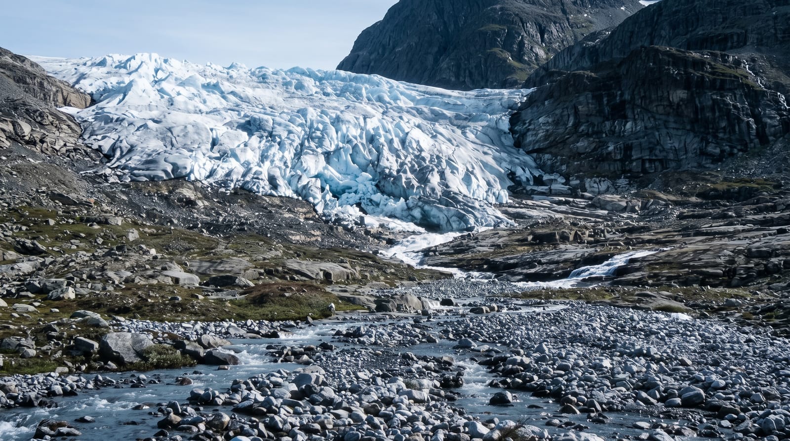
Solheimajokull runs down from Myrdalsjokull, the ice cap that covers the Katla volcano, and it is the most visited glacier tongue on the south coast because the walk from the car park to the ice takes a quarter of an hour. It is also the clearest local demonstration of retreat: the snout has pulled back by well over a kilometre since measurements began in the early twentieth century, a lagoon has grown where the ice used to sit, and the walk from the parking area has got steadily longer within living memory. Guided walks go onto the tongue with crampons; the surface is grey with ash bands from Katla and Eyjafjallajokull.
Highlights
- A tongue off Myrdalsjokull - the ice cap that covers Katla.
- Retreat you can pace out - the snout has withdrawn over a kilometre in a century.
- A lagoon where ice was - water filling the ground the glacier left.
- Ash bands in grey ice - layers from Katla and Eyjafjallajokull.
When to go
Year round; guided walks operate in every season. Half a day.
Things to know
Walking on the ice without a guide and crampons is genuinely dangerous, with crevasses on the tongue and cold water in the lagoon. The approach path is gravel and often muddy. The ice is grey rather than blue on the surface. Parking is charged.
Nearby
Skogafoss is west; Dyrholaey and Vik are along the coast east.
Key facts
Source: Wikidata, item Q1405353, read on 18 October 2026.
What to pack for Solheimajokull
Chosen from what this place is for. Tap a kit for the full checklist.
- Broken-in walking shoes or boots - Grip and ankle support matter more than looks; never hike in brand-new boots. Find on Amazon
- Reef-safe sunscreen - High SPF that will not bleach the coral you are swimming over. Find on Amazon
- Warm base layers - Merino or synthetic against the skin - never cotton, which chills when damp. Find on Amazon
- Layers + a waterproof shell - Mountain weather turns fast; a packable rain jacket saves the day. Find on Amazon
Some links on this page are Amazon affiliate links - if you buy through them we may earn a small commission at no extra cost to you.
All packing kitsPlan your trip
Where to start if Solheimajokull is going on the list.
Booking links on this page are affiliate links - if you book through them we may earn a small commission at no extra cost to you. It never changes what we write about a place.
Opening times, ticket prices and seasonal closures change - check the official source before you go: official site.