Jeannette Kawas National Park
A coastal park west of Tela with lagoons, mangrove, rainforest and beaches on Punta Sal, reached mostly by boat.
Updated 19 October 2026
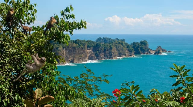
The park on the Punta Sal peninsula west of Tela packs an unusual number of habitats into a small area: rainforest running down to the sea, the Micos lagoon behind a sandbar, mangrove channels, coral in the shallows and long empty beaches. It is named for Jeannette Kawas, the conservationist who fought for its protection and was killed in 1995. Boats from Tela run the standard day trip, taking in the lagoon, a forest walk across the point and a beach stop.
History
The park was established on 4 November 1994 as Punta Sal National Park, created and managed by the PROLANSATE foundation, and it was renamed in honour of Jeannette Kawas, the foundation's president, an environmental activist who was killed on 6 February 1995 for her work to keep palm plantations out of the park. On 28 March 1995 it was listed as a Ramsar wetland of international importance (Wikipedia, Jeannette Kawas National Park).
The landscape
- Los Micos lagoon - a large lagoon behind the sandbar, worked by boat through mangrove channels.
- The Punta Sal beaches - sand on both sides of the peninsula with forest behind.
- The forest trail - a walk across the point through lowland rainforest with howler monkeys.
- The reef - coral in the shallows off the point, snorkelled from the boat.
When to go
February to May is the driest window on this coast. The northern Caribbean coast gets rain in most months and heavily from September to January. Seas are calmest early in the day.
Good to know
Almost all visits are on organised boat trips from Tela and independent access is limited. The sea crossing is open and gets rough by afternoon. The village of Miami on the sandbar is a working community, not an attraction, and treating it as one is not welcome.
Nearby
Tela is east along the coast, and Punta Izopo is on the other side of the bay.
Key facts
Source: Wikidata, item Q1685981, read on 18 October 2026.
What to pack for Jeannette Kawas National Park
Chosen from what this place is for. Tap a kit for the full checklist.
- Broken-in walking shoes or boots - Grip and ankle support matter more than looks; never hike in brand-new boots. Find on Amazon
- Reef-safe sunscreen - High SPF that will not bleach the coral you are swimming over. Find on Amazon
- Your own mask + snorkel - A well-fitting mask is the single biggest comfort upgrade underwater. Find on Amazon
- Binoculars - The single best wildlife tool - even a compact pair transforms a sighting. Find on Amazon
Some links on this page are Amazon affiliate links - if you buy through them we may earn a small commission at no extra cost to you.
All packing kitsPlan your trip
Where to start if Jeannette Kawas National Park is going on the list.
Booking links on this page are affiliate links - if you book through them we may earn a small commission at no extra cost to you. It never changes what we write about a place.
Opening times, ticket prices and seasonal closures change - check the official source before you go: official site.