Borkum
The westernmost and largest East Frisian island, far enough out that its air is classed as high-sea climate.
Updated 19 October 2026
AI illustration
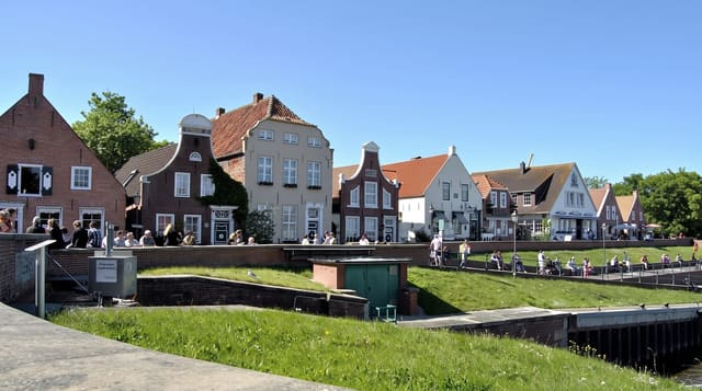
Borkum lies about thirty kilometres offshore at the mouth of the Ems, the westernmost of the East Frisian islands and the largest at around thirty-one square kilometres. Its distance from the mainland gives it what German climatology calls Hochseeklima, high-sea climate, with very low pollen and allergen counts, which is the basis of its long use for respiratory treatment. Whaling was the island's business in the seventeenth and eighteenth centuries, and fences and garden borders made from whale jawbones still stand in the village. A narrow-gauge railway of 1888 runs from the harbour to the town.
History
In 1484 the island, then called Bant, passed to the counts of East Frisia, who encouraged trade, and it became known for piracy and whaling; violent storms in the 18th century had split Bant into three islands by 1781. As whaling declined, the islanders grew poor and many left, the population falling from 852 in 1776 to 406 by 1811, until the first tourists arrived in 1834 and the island prospered as a resort (Wikipedia, Borkum).
What you'll find
- The whale bone fences - jawbones used as garden borders in the village.
- The narrow-gauge railway - an 1888 line from the harbour to the town.
- The high-sea air - low pollen conditions used for respiratory treatment.
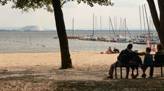
- The long beaches - wide sand on the seaward side with beach chairs.
When to go
May to September for the beach; the crossing takes about two hours and is weather dependent. Winter is stormy with reduced services and few places open.
Things to know
The ferry crossing is long and can be rough. The island is far out and expensive to reach. The North Sea is cold and the wind constant.
Nearby
Juist lies east; the Dutch islands continue west.
What to pack for Borkum
Chosen from what this place is for. Tap a kit for the full checklist.
- Reef-safe sunscreen - High SPF that will not bleach the coral you are swimming over. Find on Amazon
- Binoculars - The single best wildlife tool - even a compact pair transforms a sighting. Find on Amazon
- Quick-dry towel - A microfibre towel packs small and dries in minutes. Find on Amazon
- A zoom camera or long lens - Animals rarely come close; reach beats megapixels. Find on Amazon
Some links on this page are Amazon affiliate links - if you buy through them we may earn a small commission at no extra cost to you.
All packing kitsPlan your trip
Where to start if Borkum is going on the list.
Booking links on this page are affiliate links - if you book through them we may earn a small commission at no extra cost to you. It never changes what we write about a place.
Opening times, ticket prices and seasonal closures change - check the official source before you go: official site.