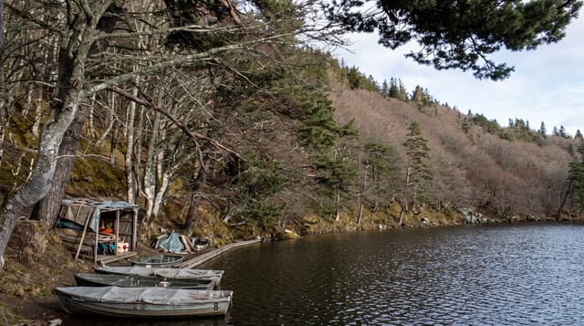
Puy de Sancy
The highest point of the Massif Central, the eroded core of a volcano, with the Dordogne starting below it.
Updated 4 September 2026
AI illustration
At one thousand eight hundred and eighty-six metres the Puy de Sancy is the highest summit in the Massif Central and in mainland France outside the Alps and Pyrenees. It is what remains of a stratovolcano active until roughly two hundred and twenty thousand years ago, worn down by glaciers into a jagged ridge of dikes and cirques rather than a cone. The Dore and the Dogne meet just below the north side and become the Dordogne. A cable car climbs most of the way from Le Mont-Dore and a long wooden stairway covers the last stretch, which keeps walkers off the fragile summit soils.
Highlights
- The eroded volcano - ridges and cirques rather than a cone.
- The summit stairway - a boarded climb protecting the fragile ground.
- The Dordogne source - two streams joining below the north face.
- The Monts Dore panorama - volcanic summits across Auvergne.
When to go
June to October for walking; the area works as a ski resort in winter with the cable car running. Cloud sits on the summit often, so a clear forecast matters.
Practical notes
The summit is frequently in cloud with no view at all. The final stairway is long and exposed to wind. Cable car queues build on fine weekends and it closes in high wind.
Nearby
Le Mont-Dore lies below; Lac Pavin is southeast.
Key facts
Source: Wikidata, item Q778597, read on 18 October 2026.
What to pack for Puy de Sancy
Chosen from what this place is for. Tap a kit for the full checklist.
- Broken-in walking shoes or boots - Grip and ankle support matter more than looks; never hike in brand-new boots. Find on Amazon
- Warm base layers - Merino or synthetic against the skin - never cotton, which chills when damp. Find on Amazon
- Layers + a waterproof shell - Mountain weather turns fast; a packable rain jacket saves the day. Find on Amazon
- An insulated + windproof jacket - A down or synthetic layer under a hard shell handles most cold. Find on Amazon
Some links on this page are Amazon affiliate links - if you buy through them we may earn a small commission at no extra cost to you.
All packing kitsPlan your trip
Where to start if Puy de Sancy is going on the list.
Booking links on this page are affiliate links - if you book through them we may earn a small commission at no extra cost to you. It never changes what we write about a place.
Opening times, ticket prices and seasonal closures change - check the official source before you go: official site.