Montsegur
A fortress on a limestone pog where a ten-month siege ended in 1244 with over two hundred burned.
Updated 19 October 2026
AI illustration
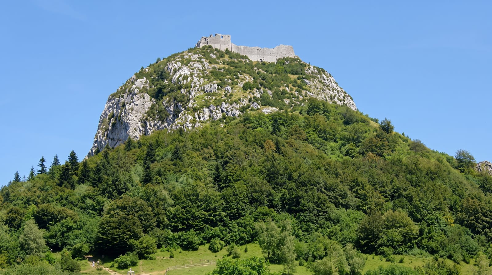
Montsegur sits at one thousand two hundred and seven metres on a pog, a local word for an isolated rocky peak. It was rebuilt from 1204 as a refuge for the Cathar church and became its effective centre; royal forces besieged it from May 1243, and after the fall in March 1244 more than two hundred perfects who refused to abjure walked down and were burned in a stockade at the foot, at a place now marked by a stele. The castle standing today is largely the French rebuilding after the siege, not the Cathar one, a distinction the site explains and much popular writing ignores.
History
Neanderthals lived in the area tens of thousands of years ago, Roman coins and tools have been found around the site, and the name comes from the Latin mons securus, "secure mountain". The castle was fortified in 1204, in a region ruled in turn by the Counts of Toulouse, the Viscounts of Carcassonne and the Counts of Foix, and Cathars took refuge there; in 1243-44 some 10,000 troops besieged them, and when they surrendered in March 1244 about 244 who refused to renounce their faith were burned at the foot of the rock, remembered every year on 16 March. The present fortress, though often called a Cathar castle, dates from a later period, and it has been a listed historic site since 1862 (Wikipedia, Montségur).
The main sights
- The pog - an isolated rock peak with the castle on its summit.
- The rebuilt fortress - post-1244 French work rather than the Cathar castle.
- The memorial field - the stele below marking the 1244 burning.
- The Pyrenean panorama - the range and foothills from the walls.
When to go
May to October; the climb is steep and can be icy or snowbound in winter, when the site closes. Cloud often covers the pog. Allow forty minutes up.
Practical notes
The path is steep, rocky and demanding, and it defeats some visitors. What stands is the later fortress, not the Cathar building, which disappoints people expecting otherwise. The village below is very small.
Nearby
Foix lies northwest; the Niaux cave is southwest.
What to pack for Montsegur
Chosen from what this place is for. Tap a kit for the full checklist.
- Head torch + spare batteries - Hands-free light is essential; caves are truly dark. Find on Amazon
- Comfortable walking shoes - Sightseeing means kilometres of pavement and cobbles daily. Find on Amazon
- Grippy closed shoes - Cave floors are wet, muddy and slick with formations. Find on Amazon
- A slim anti-theft daypack - Zips that close properly; keep it in front in crowds and on transit. Find on Amazon
Some links on this page are Amazon affiliate links - if you buy through them we may earn a small commission at no extra cost to you.
All packing kitsPlan your trip
Where to start if Montsegur is going on the list.
Booking links on this page are affiliate links - if you book through them we may earn a small commission at no extra cost to you. It never changes what we write about a place.
Opening times, ticket prices and seasonal closures change - check the official source before you go: official site.