La Hague Peninsula
Cliffs and heath at Normandy's northwest tip, with a tidal race offshore among the fastest in Europe.
Updated 4 September 2026

AI illustration
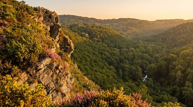
La Hague is the blunt northwestern corner of the Cotentin, a landscape of granite cliffs, heather moor, dry stone walls and small hamlets that feels closer to Cornwall or Ireland than to the rest of Normandy. Nez de Jobourg is among the highest cliffs in Europe by some counts, dropping around a hundred and twenty-eight metres. Off the point runs the Raz Blanchard, a tidal race between the peninsula and Alderney where the stream reaches speeds among the fastest in Europe, a serious hazard for shipping. The GR223 coast path follows the cliff line. The painter Millet was born at Gruchy in the middle of it.
What you'll find
- Nez de Jobourg - granite cliffs among the highest on the European coast.
- The Raz Blanchard - a tidal race visible as broken water off the point.
- The moorland - heather, gorse and dry stone walls across the headland.
- Gruchy - the hamlet where Millet was born, with his house.
When to go
April to October for walking; heather colours the moor in late summer. Winter storms make the cliffs dangerous. Wind here is constant and strong in any season.
Things to know
Cliff paths are exposed and unfenced with long drops. Weather changes quickly. A nuclear reprocessing plant occupies part of the peninsula and is visible from several viewpoints.
Nearby
Cherbourg lies east; Barfleur is northeast.
What to pack for La Hague Peninsula
Chosen from what this place is for. Tap a kit for the full checklist.
- Broken-in walking shoes or boots - Grip and ankle support matter more than looks; never hike in brand-new boots. Find on Amazon
- Layers + a waterproof shell - Mountain weather turns fast; a packable rain jacket saves the day. Find on Amazon
- Daypack with rain cover - 20-30 litres holds water, snacks, layers and a first-aid kit. Find on Amazon
- Offline maps + a power bank - Download the trail before you lose signal; carry backup charge. Find on Amazon
Some links on this page are Amazon affiliate links - if you buy through them we may earn a small commission at no extra cost to you.
All packing kitsPlan your trip
Where to start if La Hague Peninsula is going on the list.
Booking links on this page are affiliate links - if you book through them we may earn a small commission at no extra cost to you. It never changes what we write about a place.
Opening times, ticket prices and seasonal closures change - check the official source before you go: official site.