Crozon Peninsula
A cross-shaped headland of quartzite cliffs and clear coves, with water that turns turquoise over white sand.
Updated 4 September 2026

AI illustration
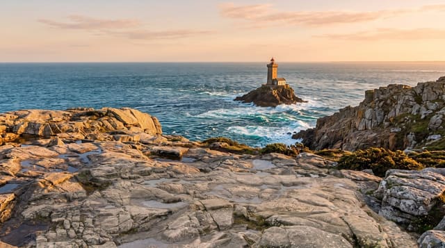
The Crozon peninsula juts west between two bays in a rough cross shape, built of hard quartzite and schist that the Atlantic has cut into cliffs, arches and stacks. Where the rock breaks down into white sand, the shallow water over it turns a strong turquoise, which is why beaches here look Mediterranean in photographs taken on the right day. The Pointe de Pen-Hir ends in the Tas de Pois, a line of rock stacks running out to sea; the Pointe de Dinan carries a natural arch called the Chateau de Dinan. Wartime bunkers stand on several headlands. The GR34 follows the whole coast.
What's there
- The Tas de Pois - a line of stacks running seaward from Pen-Hir.
- The turquoise coves - clear water over white sand at Morgat and elsewhere.
- The Chateau de Dinan - a natural rock arch resembling a ruined castle.
- The coast path - the GR34 around the whole peninsula.
When to go
May to September for swimming and clear water; the sea is cold even in August. Spring brings gorse and thrift on the cliffs. Winter storms are severe and paths close.
What to expect
The water is genuinely cold whatever the colour suggests. Cliff paths are exposed and unfenced. Public transport on the peninsula is limited and a car is close to essential.
Nearby
Brest lies north; Locronan is southeast.
Key facts
Source: Wikidata, item Q1343332, read on 18 October 2026.
What to pack for Crozon Peninsula
Chosen from what this place is for. Tap a kit for the full checklist.
- Broken-in walking shoes or boots - Grip and ankle support matter more than looks; never hike in brand-new boots. Find on Amazon
- Reef-safe sunscreen - High SPF that will not bleach the coral you are swimming over. Find on Amazon
- Layers + a waterproof shell - Mountain weather turns fast; a packable rain jacket saves the day. Find on Amazon
- Quick-dry towel - A microfibre towel packs small and dries in minutes. Find on Amazon
Some links on this page are Amazon affiliate links - if you buy through them we may earn a small commission at no extra cost to you.
All packing kitsPlan your trip
Where to start if Crozon Peninsula is going on the list.
Booking links on this page are affiliate links - if you book through them we may earn a small commission at no extra cost to you. It never changes what we write about a place.
Opening times, ticket prices and seasonal closures change - check the official source before you go: official site.