Sorve Lighthouse
A lighthouse at the tip of Saaremaa's long southern peninsula, on a spit reaching toward Latvia.
Updated 21 October 2026
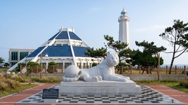
The Sorve peninsula runs south from Saaremaa for some thirty kilometres, narrowing to a spit that points across the Irbe strait toward Latvia, and the lighthouse stands at the end of it, a concrete tower of about fifty metres built in 1960 replacing earlier structures destroyed in the war. It can be climbed in season for a view along the peninsula and out over the strait, with the Latvian coast visible on clear days. The peninsula itself is thinly settled, with fishing villages, juniper heath, shingle beaches and a considerable number of wartime fortifications and a military museum at Sorve.
History
The first lighthouse on the Sõrve Peninsula was built of wood in 1646 and replaced in stone in 1650 to a design by Heinrich Stegeling. Privately run until 1737, when the state took it over, the rectangular tower was rebuilt in 1770, raised in 1807, and in 1863 brought to a height of 35 metres and fitted with a catoptric light. It came through the First World War with its wooden interior burned, but the whole structure was wrecked in 1944; a temporary wooden tower served until 1960, when the present cylindrical tower of reinforced concrete replaced it (Wikipedia, Sõrve Lighthouse).
What to look for
- The lighthouse - the concrete tower at the peninsula's end.
- The spit - the narrowing land pointing toward Latvia.
- The strait view - the water and the Latvian coast on clear days.
- Peninsula villages - the fishing settlements along the road down.
When to go
May to September, when the tower is open for climbing and the road is easiest; hours are seasonal and the lighthouse is closed in winter. Wind on the spit is strong year round.
Practical notes
Climbing access is seasonal and limited hours. The peninsula road is long and the drive from Kuressaare takes about an hour each way. The spit is exposed and windy. Facilities at the tip are minimal.
Nearby
Kuressaare lies north; Panga cliff is on the northern coast of Saaremaa.
Key facts
Source: Wikidata, item Q3376479, read on 18 October 2026.
What to pack for Sorve Lighthouse
Chosen from what this place is for. Tap a kit for the full checklist.
- Travel rod + reel - A packable multi-piece rod fits in a case and covers most holiday fishing. Find on Amazon
- Reef-safe sunscreen - High SPF that will not bleach the coral you are swimming over. Find on Amazon
- Comfortable walking shoes - Sightseeing means kilometres of pavement and cobbles daily. Find on Amazon
- A small tackle selection - Hooks, weights, line and a few lures or flies suited to local waters. Find on Amazon
Some links on this page are Amazon affiliate links - if you buy through them we may earn a small commission at no extra cost to you.
All packing kitsPlan your trip
Where to start if Sorve Lighthouse is going on the list.
Booking links on this page are affiliate links - if you book through them we may earn a small commission at no extra cost to you. It never changes what we write about a place.
Opening times, ticket prices and seasonal closures change - check the official source before you go: official site.