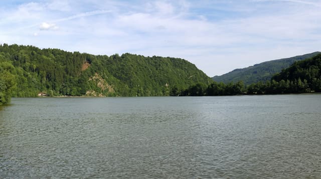
Intag Valley
A remote cloud forest valley west of Cotacachi, known for community reserves and a long fight against mining.
Updated 19 October 2026
The Intag valley drops westward from the Cotacachi paramo into subtropical cloud forest, a remote farming country of scattered villages, coffee plots and forest remnants that has become known for two things: community ecological reserves and lodges built around them, and a decades-long resistance by its communities to copper mining concessions, which has made Intag a name in Latin American environmental politics and remains unresolved. For a visitor it offers cloud forest walking, a strong community tourism network with homestays, small thermal pools at Nangulvi, coffee farms that receive guests, and craft groups working with cabuya fibre. Getting there is a slow winding road, which is why it stays quiet.
Highlights
- Community forest reserves - the locally run protected patches.
- Nangulvi thermal pools - the valley's hot springs on the river.
- Coffee farms receiving visitors - the valley's crop shown and sold.
- The anti-mining story - the communities' long unresolved fight.
When to go
June to September for drier trails. Two days, given the journey. Buses from Otavalo are slow; a car helps. Homestays and lodges are booked through the community network.
Things to know
The road is long, winding and slow, and landslides interrupt it in the wet season. Facilities are simple. Rain comes at any season.
Nearby
Cotacachi and Cuicocha are over the ridge; Otavalo lies east.
What to pack for Intag Valley
Chosen from what this place is for. Tap a kit for the full checklist.
- Broken-in walking shoes or boots - Grip and ankle support matter more than looks; never hike in brand-new boots. Find on Amazon
- Layers for big temperature swings - Warm sun by day, near-freezing at night, even near the equator. Find on Amazon
- Swimwear - Needed at most public thermal pools; some traditional baths are nude and single-sex. Find on Amazon
- Layers + a waterproof shell - Mountain weather turns fast; a packable rain jacket saves the day. Find on Amazon
Some links on this page are Amazon affiliate links - if you buy through them we may earn a small commission at no extra cost to you.
All packing kitsPlan your trip
Where to start if Intag Valley is going on the list.
Booking links on this page are affiliate links - if you book through them we may earn a small commission at no extra cost to you. It never changes what we write about a place.
Opening times, ticket prices and seasonal closures change - check the official source before you go: official site.