South Funen Archipelago
A drowned ice-age landscape of some fifty islands and shallow water south of Funen, sailed rather than driven.
Updated 21 October 2026
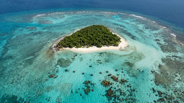
The archipelago south of Funen is a landscape that was hills and valleys until the sea rose after the last glaciation and flooded it, leaving about fifty islands and islets in shallow water with the drowned hills as their shapes. The bigger islands are inhabited and farmed, Aero, Tasinge, Thuro, Lyo, Avernako and Drejo among them, connected by a ferry network; the smaller are uninhabited grazing islands or bird reserves. It is the main cruising ground for Danish sailing, with short hops between harbours, sheltered water and a dense network of small ports, and the whole area is a proposed nature park. Cycling between ferry crossings is the standard way to see it without a boat.
The landscape
- A drowned ice-age landscape - flooded hills making the island shapes.
- A dense ferry network - short crossings linking the inhabited islands.
- Small harbours - the sailing ports that define the cruising ground.
- Grazing and bird islands - the uninhabited islets between the larger ones.
When to go
May to September; ferries run reduced timetables outside that and many island services close. Three days to a week for a proper circuit. July is the sailing peak and harbours fill. Spring is best for birds.
What to expect
Without a boat you are tied to ferry timetables, which are infrequent and require planning. Island accommodation is limited and books out in summer. Weather can strand you. Winter services are minimal and much is closed.
Nearby
Svendborg and Faaborg are the mainland bases; Aeroskobing is the best-known island town.
Key facts
Source: Wikidata, item Q1270287, read on 18 October 2026.
What to pack for South Funen Archipelago
Chosen from what this place is for. Tap a kit for the full checklist.
- Reef-safe sunscreen - High SPF that will not bleach the coral you are swimming over. Find on Amazon
- Padded shorts - The one thing that makes a full day in the saddle bearable. Find on Amazon
- Quick-dry towel - A microfibre towel packs small and dries in minutes. Find on Amazon
- Helmet - Bring your own if you have a good one; rentals vary wildly. Find on Amazon
Some links on this page are Amazon affiliate links - if you buy through them we may earn a small commission at no extra cost to you.
All packing kitsPlan your trip
Where to start if South Funen Archipelago is going on the list.
Booking links on this page are affiliate links - if you book through them we may earn a small commission at no extra cost to you. It never changes what we write about a place.
Opening times, ticket prices and seasonal closures change - check the official source before you go: official site.