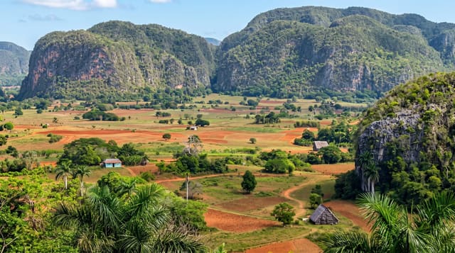
Guanahacabibes National Park
A limestone peninsula at Cuba's western tip, a biosphere reserve of dry forest, sinkholes and turtle nesting beaches.
Updated 1 September 2026
Guanahacabibes covers the long limestone peninsula that runs out to Cabo San Antonio at the western end of Cuba, a biosphere reserve of semi-deciduous forest, mangrove, cenotes and low karst. Green turtles nest on the southern beaches through the summer and the park runs a monitoring programme that visitors can join. Bird and land crab numbers are high, the endemic plant list is long, and the road out to the cape is one of the emptiest in the country.
The landscape
- The dry forest trails - guided walks through semi-deciduous forest with a high endemic count.
- The cenotes - flooded sinkholes in the limestone along the trails.
- The turtle nesting - green turtles on the southern beaches in summer, monitored by the park.
- Cabo San Antonio - the western tip of Cuba, with a lighthouse and nothing else.
When to go
November to April is the dry season and best for walking. Turtle nesting runs from roughly June to September, which is the wet and hot season. Guides are compulsory on the trails and are arranged at La Bajada.
Things to know
Trails cannot be walked without a park guide and numbers are limited, so arriving unannounced can mean waiting. Mosquitoes and land crabs are abundant. The road to the cape is rough and there is no fuel or food on the peninsula.
Nearby
Maria la Gorda is on the bay inside the peninsula, and Sandino is the nearest town.
What to pack for Guanahacabibes National Park
Chosen from what this place is for. Tap a kit for the full checklist.
- Broken-in walking shoes or boots - Grip and ankle support matter more than looks; never hike in brand-new boots. Find on Amazon
- Reef-safe sunscreen - High SPF that will not bleach the coral you are swimming over. Find on Amazon
- Binoculars - The single best wildlife tool - even a compact pair transforms a sighting. Find on Amazon
- Layers + a waterproof shell - Mountain weather turns fast; a packable rain jacket saves the day. Find on Amazon
Some links on this page are Amazon affiliate links - if you buy through them we may earn a small commission at no extra cost to you.
All packing kitsPlan your trip
Where to start if Guanahacabibes National Park is going on the list.
Booking links on this page are affiliate links - if you book through them we may earn a small commission at no extra cost to you. It never changes what we write about a place.
Opening times, ticket prices and seasonal closures change - check the official source before you go: official site.