Juan Castro Blanco National Park
A cloud forest park in the San Carlos highlands protecting the springs that supply much of the northern lowlands.
Updated 19 October 2026
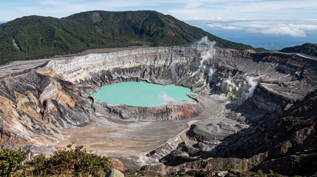
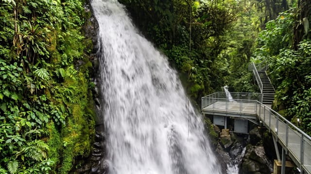
Juan Castro Blanco covers around a hundred and forty square kilometres of cloud forest and paramo on the volcanic highlands north of the Central Valley, and it is known as the water park: dozens of rivers rise within it, supplying drinking water and hydroelectric generation across the San Carlos region, which is why it was protected in 1992 after local campaigning. Platanar and Porvenir volcanoes stand within it. The forest holds quetzals, bare-necked umbrellabirds, tapirs and a substantial amphibian list. Visitor infrastructure is minimal: a few trails, some access points reached by rough road, and much of the park closed to visitors, so trips are usually guided from Ciudad Quesada or Bajos del Toro.
History
The Juan Castro Blanco Forest Reserve was created on 26 June 1975 with about 13,700 hectares, it was made a protected zone of 14,250 hectares in 1989, and on 22 April 1992 Decree No. 9279 made it a national park, in the Arenal Huetar Norte Conservation Area some 100 kilometres north of San José (Wikipedia, Juan Castro Blanco National Park).
Highlights
- Cloud forest - the dense wet forest across the volcanic slopes.
- River sources - the springs and headwaters the park protects.
- Platanar and Porvenir - the volcanoes within the boundaries.
- Cloud forest birds - quetzals, umbrellabirds and hummingbirds.
When to go
December to April in the drier season for the roads and trails; this is one of the wettest parts of the country and rain is likely in any month. Mornings are clearest and best for birds.
Before you go
Access is limited and much of the park is closed; guided trips from nearby towns are the practical way in. Roads to the access points are rough. Rain and mud are constant. There is almost no visitor infrastructure.
Nearby
Bajos del Toro lies south; Ciudad Quesada is northwest.
Key facts
Source: Wikidata, item Q4175950, read on 18 October 2026.
What to pack for Juan Castro Blanco National Park
Chosen from what this place is for. Tap a kit for the full checklist.
- Broken-in walking shoes or boots - Grip and ankle support matter more than looks; never hike in brand-new boots. Find on Amazon
- Binoculars - The single best wildlife tool - even a compact pair transforms a sighting. Find on Amazon
- Layers for big temperature swings - Warm sun by day, near-freezing at night, even near the equator. Find on Amazon
- Layers + a waterproof shell - Mountain weather turns fast; a packable rain jacket saves the day. Find on Amazon
Some links on this page are Amazon affiliate links - if you buy through them we may earn a small commission at no extra cost to you.
All packing kitsPlan your trip
Where to start if Juan Castro Blanco National Park is going on the list.
Booking links on this page are affiliate links - if you book through them we may earn a small commission at no extra cost to you. It never changes what we write about a place.
Opening times, ticket prices and seasonal closures change - check the official source before you go: official site.