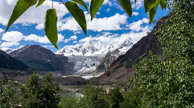
Mount Kailash
A near-pyramidal peak sacred to four religions, circled on a three-day walk over a 5,600-metre pass.
Updated 4 September 2026

AI illustration
Kailash rises to 6,638 metres as an isolated near-symmetrical mass with horizontal strata and a snow cap, and it is held sacred by Hindus, Buddhists, Jains and Bon practitioners, none of whom climb it; it has never been summited and climbing is not permitted. What people do instead is the kora, a circuit of about fifty-two kilometres walked clockwise, or anticlockwise by Bon practitioners, over three days from Darchen, crossing the Drolma La at around 5,630 metres on the second day. Some pilgrims prostrate the entire circuit, taking weeks. Four great rivers of Asia rise within the surrounding region.
What's there
- The peak - a near-pyramidal mountain with horizontal banding and snow cap.
- The kora - a fifty-two kilometre circuit walked over three days.
- The Drolma La - the 5,630-metre pass crossed on the second day.
- The prostrating pilgrims - full-body prostrations around the whole circuit.
When to go
May to October, with the Saga Dawa festival in late spring drawing the largest pilgrim numbers; winter closes the route with snow. Weather at the pass is unpredictable in any season.
Good to know
This is among the most remote places reachable in China, requiring days of driving and permits arranged well in advance. The pass crossing at 5,630 metres is demanding and altitude sickness is common. Facilities on the kora are minimal.
Nearby
Lake Manasarovar lies south; the Guge ruins are west.
Key facts
Source: Wikidata, item Q229107, read on 18 October 2026.
What to pack for Mount Kailash
Chosen from what this place is for. Tap a kit for the full checklist.
- Broken-in walking shoes or boots - Grip and ankle support matter more than looks; never hike in brand-new boots. Find on Amazon
- Warm base layers - Merino or synthetic against the skin - never cotton, which chills when damp. Find on Amazon
- Modest clothing - Shoulders and knees covered - the single most common requirement. Find on Amazon
- Layers + a waterproof shell - Mountain weather turns fast; a packable rain jacket saves the day. Find on Amazon
Some links on this page are Amazon affiliate links - if you buy through them we may earn a small commission at no extra cost to you.
All packing kitsPlan your trip
Where to start if Mount Kailash is going on the list.
Booking links on this page are affiliate links - if you book through them we may earn a small commission at no extra cost to you. It never changes what we write about a place.
Opening times, ticket prices and seasonal closures change - check the official source before you go: official site.