Lake Chad
The shape-shifting sea of the Sahel - papyrus islands, floating pastures and fishing cultures on the great lake that maps can never pin down.
Updated 16 October 2026
AI illustration
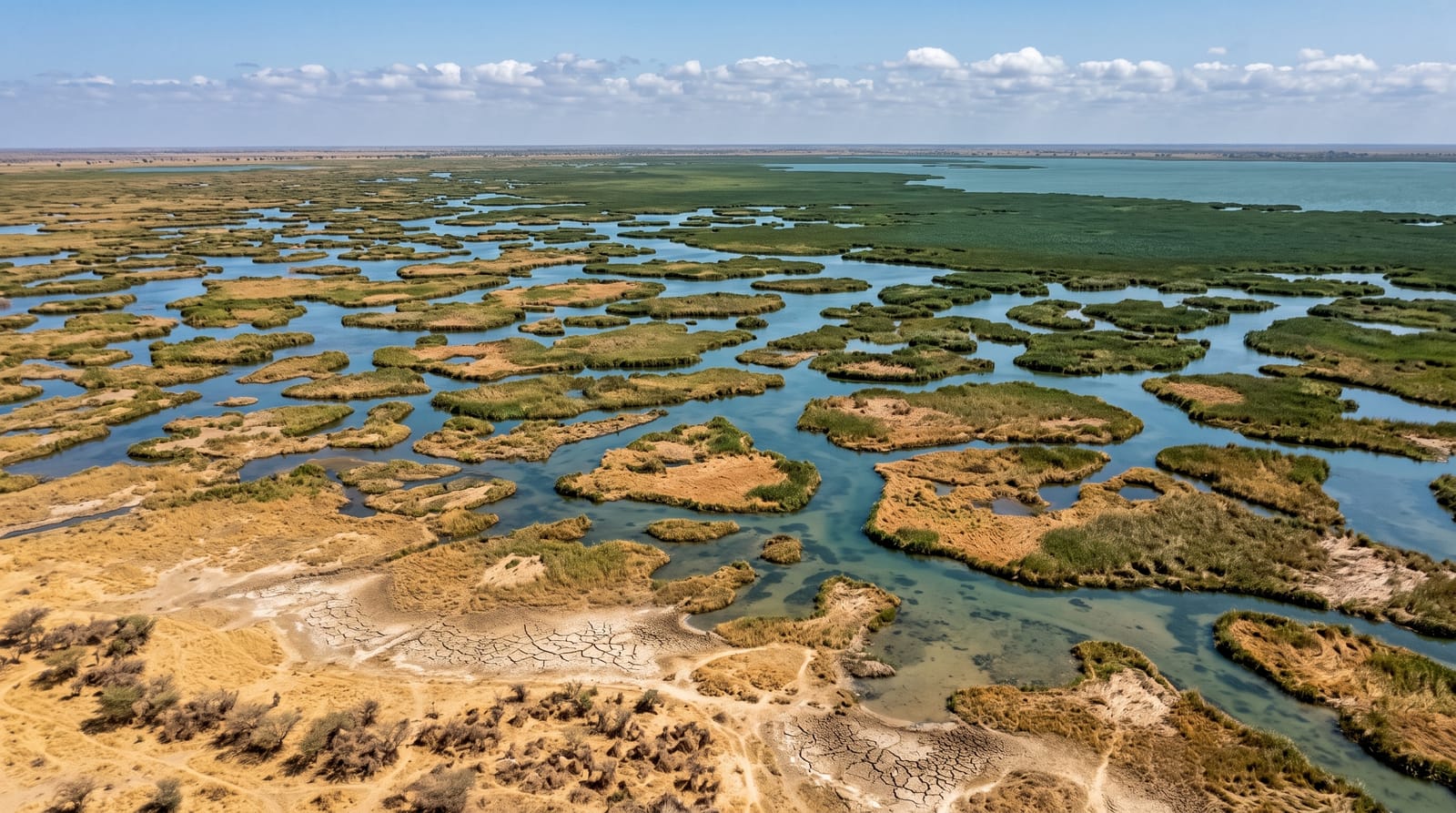
Lake Chad named the country and defies its cartographers: the great Sahel lake swells and shrinks with the years, a mosaic of open water, papyrus archipelagos and seasonally flooded pastures where island communities fish from pirogues, herd cattle that swim between grazings, and grow spirulina - the algae harvested and dried here by Kanembu women generations before the health-food aisle discovered it. Visits run from Bol on the eastern arm: pirogue channels between reed islands, bird clouds working the shallows, and the sense of moving across a geography that negotiates its own outline annually.
Background
The lake sits where Nigeria, Niger, Chad and Cameroon meet, has no outlet, and drains a catchment of more than 1,000,000 km2. Most of its water comes from the Chari River, and the southern parts are deeper than the northern ones. In the 19th century it still covered 28,000 km2, but its open water shrank to just 2000 km2 in 1980, down from 25,000 km2 in 1960, and it is no longer thought to be shrinking. An ancient predecessor, Mega-Chad, was more than 180 metres deep and spread over approximately 400000 square kilometres. By 1800 BC the Gajiganna pottery culture had appeared here, and permanent villages stood south of the lake by 500 BC.
Source: Wikipedia, "Lake Chad"
What you'll find
- The papyrus archipelagos - reed islands threading the open water.
- The pirogue channels - fishing and ferrying between the isles.
- The spirulina harvest - Kanembu women's ancient superfood tradition.
- The bird shallows - pelicans and waders on the flood margins.
When to go
November to February for cool, dry travel; water levels reshape everything year to year - local knowledge in Bol is the only current map. Mornings on the water beat wind and heat both.
Practical notes
Trips run through operators and local authorities who know the day's picture. Facilities are basic; boats are working pirogues. The lake rewards flexibility because it practises it.
Nearby
Bol's oasis and dunes, and the N'Djamena road southwest.
Key facts
Source: Wikidata, item Q125309, read on 18 October 2026.
What to pack for Lake Chad
Chosen from what this place is for. Tap a kit for the full checklist.
- Travel rod + reel - A packable multi-piece rod fits in a case and covers most holiday fishing. Find on Amazon
- Reef-safe sunscreen - High SPF that will not bleach the coral you are swimming over. Find on Amazon
- Loose, light, long clothing - Covering up beats bare skin in the desert - and locals dress this way for a reason. Find on Amazon
- A small tackle selection - Hooks, weights, line and a few lures or flies suited to local waters. Find on Amazon
Some links on this page are Amazon affiliate links - if you buy through them we may earn a small commission at no extra cost to you.
All packing kitsPlan your trip
Where to start if Lake Chad is going on the list.
Booking links on this page are affiliate links - if you book through them we may earn a small commission at no extra cost to you. It never changes what we write about a place.
Opening times, ticket prices and seasonal closures change - check the official source before you go: official site.


