Kananaskis Country
A block of provincial parks with the highest paved pass in Canada, closed for half the year for wildlife.
Updated 18 October 2026

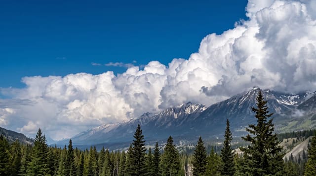
AI illustration
Kananaskis Country is a set of provincial parks and recreation areas on the eastern slopes, created in the 1970s partly to take pressure off Banff, and it is where Calgary goes at weekends. Highway 40 climbs to Highwood Pass at two thousand two hundred and six metres, the highest paved road in Canada, and it is closed from December to mid-June, not for snow but to give wildlife an undisturbed corridor through the season. The area holds one of the densest grizzly populations in Alberta. Ptarmigan Cirque, a short alpine loop from the pass, is one of the easiest ways to reach true alpine terrain in the Rockies.
History
The name goes back to 1858, when the explorer John Palliser named the Kananaskis River after a legendary Cree figure. The Alberta government created Kananaskis Country in 1978, and Premier Peter Lougheed dedicated it that September; it covers about 4,000 square kilometres. Ten years later it hosted part of the 1988 Winter Olympics - alpine skiing and freestyle moguls at Nakiska, cross-country skiing at the Canmore Nordic Centre - and on 26-27 June 2002 the G8 summit met at Kananaskis Village (Wikipedia, Kananaskis Country).
Highlights
- Highwood Pass - Canada's highest paved road at 2,206 metres.
- The seasonal closure - a road shut half the year for wildlife rather than snow.
- Ptarmigan Cirque - a short walk from the pass into alpine terrain.
- The lakes - Upper and Lower Kananaskis lakes below the peaks.
When to go
Highwood Pass opens roughly 15 June and closes 1 December; outside that the southern loop is inaccessible. The rest of Kananaskis is open year-round. Larch turn in late September.
Before you go
A Conservation Pass must be bought online and enforcement is active. Highwood Pass is closed half the year, which catches visitors out. Grizzly density is high and closures for bear activity are common.
Nearby
Canmore lies north; the Cowboy Trail runs east.
Key facts
Source: Wikidata, item Q3373468, read on 18 October 2026.
What to pack for Kananaskis Country
Chosen from what this place is for. Tap a kit for the full checklist.
- Broken-in walking shoes or boots - Grip and ankle support matter more than looks; never hike in brand-new boots. Find on Amazon
- Binoculars - The single best wildlife tool - even a compact pair transforms a sighting. Find on Amazon
- Warm base layers - Merino or synthetic against the skin - never cotton, which chills when damp. Find on Amazon
- Layers + a waterproof shell - Mountain weather turns fast; a packable rain jacket saves the day. Find on Amazon
Some links on this page are Amazon affiliate links - if you buy through them we may earn a small commission at no extra cost to you.
All packing kitsPlan your trip
Where to start if Kananaskis Country is going on the list.
Booking links on this page are affiliate links - if you book through them we may earn a small commission at no extra cost to you. It never changes what we write about a place.
Opening times, ticket prices and seasonal closures change - check the official source before you go: official site.