Gaspésie National Park
The only place south of the St. Lawrence where woodland caribou survive, on summits above the treeline.
Updated 19 October 2026
AI illustration
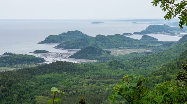
The Chic-Choc and McGerrigle mountains rise above eleven hundred metres here, high enough for arctic-alpine tundra on the summits, and they hold the last woodland caribou herd south of the St. Lawrence, isolated from all others and reduced to a few dozen animals despite intensive protection. Access to summit areas is restricted in the calving season to protect them. Mont Jacques-Cartier at one thousand two hundred and sixty-eight metres is the second highest peak in Quebec and the usual place to see caribou, reached on a controlled trail with fixed hours. The park is on the International Appalachian Trail.
History
Mi'kmaq groups have lived seasonally in the Haute-Gaspésie for at least 10,000 years, and French and then British settlers kept mostly to the coasts, so the rugged interior was little disturbed until the expeditions of the 19th century. The park was established on 14 April 1937 to protect the McGerrigle and Mont Albert environments, the salmon of the Sainte-Anne River and the remaining caribou; mining and forestry were later allowed, the Madeleine mine working from 1969 to 1982, and after the caribou declined by 60 to 80 per cent, stronger protection came with the Parks Act of 1977 and stricter laws in 1999 (Wikipedia, Gaspésie National Park).
What's there
- The caribou - the last herd south of the St. Lawrence, critically small.
- Mont Jacques-Cartier - Quebec's second highest peak with alpine tundra.
- The Chic-Chocs - a mountain range unusual in eastern Canada for its height.
- The vegetation zones - forest through krummholz to tundra in one climb.
When to go
The Mont Jacques-Cartier trail opens roughly late June to late September with fixed daily hours and a shuttle; outside that it is closed for caribou. Winter brings backcountry skiing.
Things to know
The summit trail has enforced hours and a shuttle, and closes entirely outside a short season. Caribou sightings are not guaranteed and the herd is very small. Weather above treeline turns fast.
Nearby
Forillon lies east; Reford Gardens are west.
Key facts
Source: Wikidata, item Q2051988, read on 18 October 2026.
What to pack for Gaspésie National Park
Chosen from what this place is for. Tap a kit for the full checklist.
- Broken-in walking shoes or boots - Grip and ankle support matter more than looks; never hike in brand-new boots. Find on Amazon
- Warm base layers - Merino or synthetic against the skin - never cotton, which chills when damp. Find on Amazon
- Shelter suited to the place - Tent, tarp or hut booking - match it to the terrain and rules. Find on Amazon
- Layers + a waterproof shell - Mountain weather turns fast; a packable rain jacket saves the day. Find on Amazon
Some links on this page are Amazon affiliate links - if you buy through them we may earn a small commission at no extra cost to you.
All packing kitsPlan your trip
Where to start if Gaspésie National Park is going on the list.
Booking links on this page are affiliate links - if you book through them we may earn a small commission at no extra cost to you. It never changes what we write about a place.
Opening times, ticket prices and seasonal closures change - check the official source before you go: official site.