Canyon Sainte-Anne
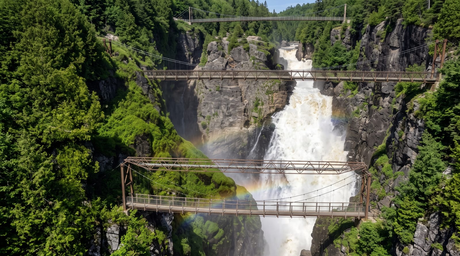
A seventy-four metre waterfall in a granite gorge, crossed by three suspension bridges at different heights.
Updated 19 October 2026
AI illustration
The Sainte-Anne-du-Nord river drops seventy-four metres into a narrow gorge cut through Precambrian granite, and the site is arranged around getting close to it: three suspension bridges cross the canyon at different levels, the highest about sixty metres above the water, with staircases and platforms down the walls. The rock is around one and a quarter billion years old. Potholes ground into the granite by trapped stones are visible along the walls. A via ferrata and zipline operate for those wanting more. The falls are strongest in spring melt and after rain, and thin considerably by late summer.
History
Loggers used the Sainte-Anne-du-Nord river early in the 20th century, and in the summer of 1965 a former logger told Jean-Marie McNicoll how to reach its falls, which he found by making his way through the woods. Two years later he and his brother Laurent leased the riverbanks from Hydro-Québec and bought the wooded land between Route 138 and the river, cleared a road, and welcomed their first visitors on 14 July 1973 (Wikipedia, Canyon Sainte-Anne).
The landscape
- The seventy-four metre fall - the main drop into the granite gorge.
- The three bridges - suspension crossings at different heights over the canyon.
- The potholes - cylindrical hollows ground into the granite walls.
- The billion-year rock - Precambrian granite exposed through the gorge.
When to go
May to October; the site closes for winter. Spring melt in May gives the strongest flow and by August it can be much reduced. Autumn colour in the gorge is good.
Before you go
Closed roughly November to April. Flow drops noticeably in late summer. The route involves many stairs and the bridges move underfoot.
Nearby
Sainte-Anne-de-Beaupré lies west; Mont-Sainte-Anne is close.
Key facts
Source: Wikidata, item Q609933, read on 18 October 2026.
What to pack for Canyon Sainte-Anne
Chosen from what this place is for. Tap a kit for the full checklist.
- Broken-in walking shoes or boots - Grip and ankle support matter more than looks; never hike in brand-new boots. Find on Amazon
- Layers + a waterproof shell - Mountain weather turns fast; a packable rain jacket saves the day. Find on Amazon
- Daypack with rain cover - 20-30 litres holds water, snacks, layers and a first-aid kit. Find on Amazon
- Offline maps + a power bank - Download the trail before you lose signal; carry backup charge. Find on Amazon
Some links on this page are Amazon affiliate links - if you buy through them we may earn a small commission at no extra cost to you.
All packing kitsPlan your trip
Where to start if Canyon Sainte-Anne is going on the list.
Booking links on this page are affiliate links - if you book through them we may earn a small commission at no extra cost to you. It never changes what we write about a place.
Opening times, ticket prices and seasonal closures change - check the official source before you go: official site.