Vina Falls
A broad fall on the Vina river south of Ngaoundere, a standard local excursion.
Updated 31 August 2026
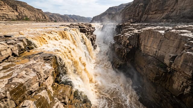
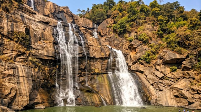
The Vina river drops over a wide basalt step south of Ngaoundere, spreading across the rock in a series of channels in the dry months and running as a single broad sheet after the rains, into a pool below with trees along the banks. It is the closest of the Adamawa falls to the town and the one most often visited, reached in under an hour on a road that is passable for most of the year. People swim in the pools below when the flow allows, and there are usually stalls and a few refreshments at the site on weekends. The plateau around is open grazing country used by Fulani herders with cattle on the move.
What's there
- A broad basalt step - the wide ledge the river crosses.
- Channels in the dry season - the water splitting across the rock.
- Pools below the fall - the swimming spots when flow allows.
- Grazing country on the plateau - cattle and herders around the site.
When to go
August to November for the fullest flow. Half a day from Ngaoundere. Weekends bring local visitors and stalls; weekdays are quiet.
Good to know
Flow is much reduced from February to May. Rocks are slippery and currents after rain are dangerous. Facilities are informal stalls at best. Entry fees are negotiated on arrival.
Nearby
Ngaoundere is north; Lake Tison lies nearby.
What to pack for Vina Falls
Chosen from what this place is for. Tap a kit for the full checklist.
- Broken-in walking shoes or boots - Grip and ankle support matter more than looks; never hike in brand-new boots. Find on Amazon
- Reef-safe sunscreen - High SPF that will not bleach the coral you are swimming over. Find on Amazon
- Layers + a waterproof shell - Mountain weather turns fast; a packable rain jacket saves the day. Find on Amazon
- Quick-dry towel - A microfibre towel packs small and dries in minutes. Find on Amazon
Some links on this page are Amazon affiliate links - if you buy through them we may earn a small commission at no extra cost to you.
All packing kitsPlan your trip
Where to start if Vina Falls is going on the list.
Booking links on this page are affiliate links - if you book through them we may earn a small commission at no extra cost to you. It never changes what we write about a place.
Opening times, ticket prices and seasonal closures change - check the official source before you go: official site.