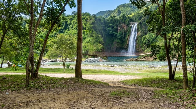
Menchum Falls
A wide fall on the Menchum river in the north-west, seen from the road above the gorge.
Updated 21 October 2026
The Menchum river drops over a wide rock shelf into a gorge on the road between Bamenda and Wum, and the fall is broad rather than tall, a curtain of brown water in the wet season spread across the full width of the riverbed and pouring into a rocky basin. The viewpoint is at the roadside above it, and paths lead down toward the water for those with a guide, though the rock is smooth and the current strong. In the dry months the flow drops sharply and the shelf is exposed. The country around is the open highland of the north-west, with scattered villages, and the road itself is rough for much of its length.
What you'll find
- A wide curtain of water - the fall spread across the riverbed.
- The roadside viewpoint - the standard place to see it from.
- The rocky gorge below - the basin the river drops into.
- Open highland country - the north-west landscape around the road.
When to go
July to October, when the river is in flood and the fall is at its widest; it shrinks a great deal by February. Two hours as a stop on the road.
Practical notes
The rock around the falls is smooth and slippery; keep well back. Flow in the dry season is disappointing. The road is rough. Confirm what conditions are like in the area before travelling out.
Nearby
Bafut is south-east; Wum lies north-west.
Key facts
Source: Wikidata, item Q4782685, read on 18 October 2026.
What to pack for Menchum Falls
Chosen from what this place is for. Tap a kit for the full checklist.
- Broken-in walking shoes or boots - Grip and ankle support matter more than looks; never hike in brand-new boots. Find on Amazon
- Layers + a waterproof shell - Mountain weather turns fast; a packable rain jacket saves the day. Find on Amazon
- Daypack with rain cover - 20-30 litres holds water, snacks, layers and a first-aid kit. Find on Amazon
- Offline maps + a power bank - Download the trail before you lose signal; carry backup charge. Find on Amazon
Some links on this page are Amazon affiliate links - if you buy through them we may earn a small commission at no extra cost to you.
All packing kitsPlan your trip
Where to start if Menchum Falls is going on the list.
Booking links on this page are affiliate links - if you book through them we may earn a small commission at no extra cost to you. It never changes what we write about a place.
Opening times, ticket prices and seasonal closures change - check the official source before you go: official site.