Xingo Canyon
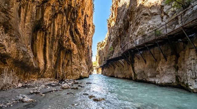
Green water between sheer walls on the Sao Francisco, a canyon that only filled when the dam closed in 1994.
Updated 29 August 2026
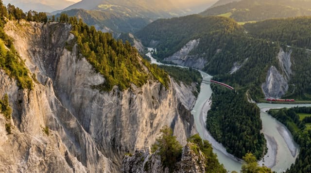
The canyon the boats run through is partly natural and partly recent: the Sao Francisco had cut a gorge here through the caatinga rock, and when the Xingo dam closed in 1994 the reservoir filled it, raising the water level by some tens of metres and drowning the lower walls. What remains above the surface is sixty to eighty metres of sandstone in ochre and red, reflected in water that reads deep green because the reservoir traps sediment upstream. Catamarans and small boats run a circuit of a couple of hours, stopping in side channels where people swim off the boat and where the walls close in tightly enough to feel enclosed. The surrounding country is caatinga and the contrast between dry scrub above and green water below is the point.
The landscape
- Sheer ochre walls - sixty to eighty metres of sandstone above the waterline.
- Green reservoir water - clear because the dam traps sediment upstream.
- A canyon filled in 1994 - the lower gorge drowned when Xingo closed.
- Swim stops in side channels - narrow arms where boats pull in.
When to go
May to November. A day. Morning trips are calmer and less hot.
Practical notes
Water level depends on reservoir management and drops in drought years, which changes how the walls look. Boats can be crowded and the circuit is fixed. There is no shade on deck. The town of Canindé has limited accommodation.
Nearby
Foz do Sao Francisco is downriver at the coast; Aracaju is south-east.
What to pack for Xingo Canyon
Chosen from what this place is for. Tap a kit for the full checklist.
- Broken-in walking shoes or boots - Grip and ankle support matter more than looks; never hike in brand-new boots. Find on Amazon
- Layers + a waterproof shell - Mountain weather turns fast; a packable rain jacket saves the day. Find on Amazon
- Daypack with rain cover - 20-30 litres holds water, snacks, layers and a first-aid kit. Find on Amazon
- Offline maps + a power bank - Download the trail before you lose signal; carry backup charge. Find on Amazon
Some links on this page are Amazon affiliate links - if you buy through them we may earn a small commission at no extra cost to you.
All packing kitsPlan your trip
Where to start if Xingo Canyon is going on the list.
Booking links on this page are affiliate links - if you book through them we may earn a small commission at no extra cost to you. It never changes what we write about a place.
Opening times, ticket prices and seasonal closures change - check the official source before you go: official site.