Itaimbezinho Canyon
Near-vertical basalt walls up to seven hundred metres deep in Aparados da Serra, walked along the rim.
Updated 29 August 2026
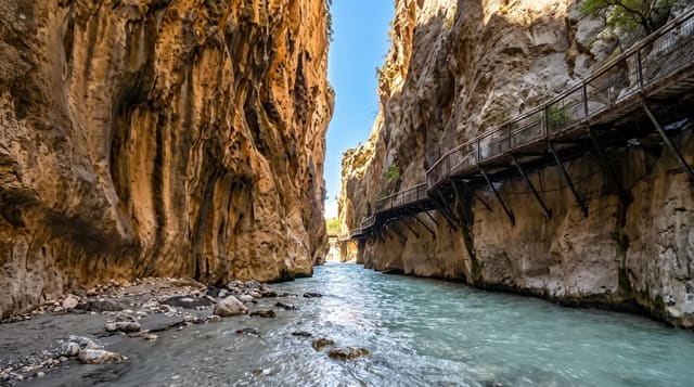
Itaimbezinho is the best known of the canyons cut into the escarpment where the southern Brazilian plateau breaks off toward the coastal plain, and its walls run close to vertical for depths of up to about seven hundred metres, with two waterfalls - Veu de Noiva and Andorinhas - dropping off the rim into the gorge. The name is Guarani for sharp stone. Two rim trails do the standard visit: the Vertentes trail of about one and a half kilometres to the head of the canyon, and the Cotovelo trail of around three kilometres to a viewpoint over the bend. The descent to the canyon floor is a separate and much harder route requiring a guide. Above the rim the vegetation is araucaria forest and high grassland, and morning cloud filling the canyon is common enough to be the thing people photograph.
The landscape
- Near-vertical walls - basalt to about seven hundred metres deep.
- Falls off the rim - Veu de Noiva and Andorinhas dropping into the gorge.
- Two rim trails - Vertentes to the head, Cotovelo to the bend.
- Cloud filling the canyon - the common early-morning condition.
When to go
April to September, with winter mornings clearest. A day.
What to expect
Entry must be booked online in advance with a time slot, and turning up without one does not work. Cloud closes the view on a large share of days, and there is no refund for weather. The rim trails are easy; the floor descent is a guided full-day undertaking. Wind on the rim is cold year round.
Nearby
Fortaleza canyon is north; Cambara do Sul is the base town.
Key facts
Source: Wikidata, item Q490320, read on 18 October 2026.
What to pack for Itaimbezinho Canyon
Chosen from what this place is for. Tap a kit for the full checklist.
- Broken-in walking shoes or boots - Grip and ankle support matter more than looks; never hike in brand-new boots. Find on Amazon
- Layers + a waterproof shell - Mountain weather turns fast; a packable rain jacket saves the day. Find on Amazon
- Daypack with rain cover - 20-30 litres holds water, snacks, layers and a first-aid kit. Find on Amazon
- Offline maps + a power bank - Download the trail before you lose signal; carry backup charge. Find on Amazon
Some links on this page are Amazon affiliate links - if you buy through them we may earn a small commission at no extra cost to you.
All packing kitsPlan your trip
Where to start if Itaimbezinho Canyon is going on the list.
Booking links on this page are affiliate links - if you book through them we may earn a small commission at no extra cost to you. It never changes what we write about a place.
Opening times, ticket prices and seasonal closures change - check the official source before you go: official site.