Florianopolis
An island capital of dozens of beaches, a lagoon, dunes and Azorean fishing villages, joined to the mainland by three bridges.
Updated 19 October 2026
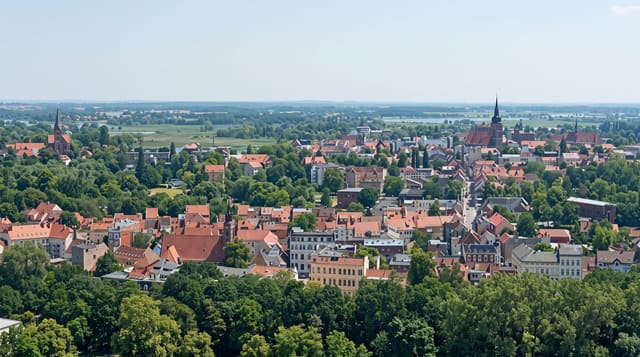
Florianopolis occupies Santa Catarina island and a strip of mainland, and the island is the point: dozens of beaches around it, with completely different characters depending on which coast you are on. The east faces open ocean with surf at Joaquina, Mole and Campeche; the north has calm shallow water at Jurere and Canasvieiras and the resort development that goes with it; the south keeps Azorean fishing villages at Pantano do Sul and Ribeirao da Ilha, where oyster farming is the industry and the accent is distinct. The Lagoa da Conceicao in the middle is the nightlife centre, with dunes beside it used for sandboarding. The Hercilio Luz bridge of 1926, reopened after long restoration, is the city's emblem.
History
The Carijó, a Tupi people, lived here first, leaving shell mounds up to 4000 years old, and called the island Meiembipe; the Portuguese landed around 1514, named it Ilha dos Patos and in 1526 renamed it Santa Catarina. Settlement began in 1673 with the bandeirante Francisco Dias Velho, followed in 1678 by a chapel to Nossa Senhora do Desterro, and the place became a village in 1714 and a town in 1726, the capital of a new captaincy in 1739 ringed by fortresses, and between 1747 and 1756 about 6,000 settlers arrived from the Azores and Madeira; Desterro became the provincial capital in 1823 and took the name Florianópolis in 1893 (Wikipedia, Florianópolis).
What to look for
- Dozens of beaches - open ocean east, calm north, fishing villages south.
- The Lagoa da Conceicao - the central lagoon and its dunes.
- Azorean villages - Ribeirao da Ilha and Pantano do Sul, with oyster farming.
- The Hercilio Luz bridge - the 1926 span, restored and reopened.
When to go
October to April. Four days. January is packed.
Before you go
In January the island fills with Argentine and Brazilian holidaymakers and traffic can take hours between north and south. Beaches are far apart and a car is close to essential. Water is cold on the ocean side. Rain is frequent.
Nearby
Lagoinha do Leste is on the same island; Guarda do Embau is south on the mainland.
Key facts
Source: Wikidata, item Q132997, read on 18 October 2026.
What to pack for Florianopolis
Chosen from what this place is for. Tap a kit for the full checklist.
- Travel rod + reel - A packable multi-piece rod fits in a case and covers most holiday fishing. Find on Amazon
- Reef-safe sunscreen - High SPF that will not bleach the coral you are swimming over. Find on Amazon
- Quick-dry clothing - Board shorts or synthetics that shrug off spray and dry fast. Find on Amazon
- Loose, light, long clothing - Covering up beats bare skin in the desert - and locals dress this way for a reason. Find on Amazon
Some links on this page are Amazon affiliate links - if you buy through them we may earn a small commission at no extra cost to you.
All packing kitsPlan your trip
Where to start if Florianopolis is going on the list.
Booking links on this page are affiliate links - if you book through them we may earn a small commission at no extra cost to you. It never changes what we write about a place.
Opening times, ticket prices and seasonal closures change - check the official source before you go: official site.