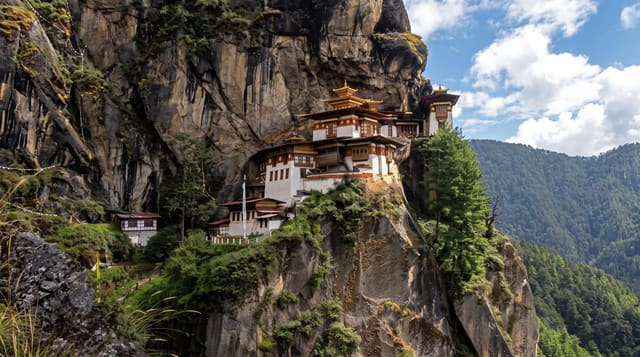
Druk Path Trek
A five-day ridge route between Paro and Thimphu past a chain of high lakes, the country's most popular short trek.
Updated 31 August 2026
The Druk Path crosses the ridge separating the Paro and Thimphu valleys, running about fifty kilometres in five days with camps at altitudes between roughly 3,500 and 4,200 metres, and it is the standard introduction to trekking in Bhutan because it is short, close to both towns and does not require a long approach. The route climbs through blue pine and rhododendron to open ridge, passing Jimilang Tsho, Simkotra Tsho and other lakes said to hold large trout, with the ruins of Jele Dzong on the first day and views north to the Himalayan border peaks in clear weather. Camps are set by the crew and yaks or ponies carry loads. Snow can close the ridge in early spring and late autumn.
What's there
- Ridge lakes - Jimilang Tsho and others strung along the route.
- Jele Dzong - the ruined fortress on the first day's climb.
- Border peaks - the Himalayan skyline north in clear weather.
- Rhododendron forest - flowering slopes in spring on the lower sections.
When to go
March to May and September to November. April brings rhododendrons; October and November give the clearest air. Snow can block the ridge in March and late November. Monsoon makes it wet and viewless.
What to expect
Camps sit above 3,500 metres and nights are cold, well below freezing in shoulder seasons. The first day climbs steeply from Paro and altitude is felt. Weather can remove the views entirely. All trekking is through a licensed operator with a crew, which sets the cost.
Nearby
Paro is the start; Thimphu is the finish.
What to pack for Druk Path Trek
Chosen from what this place is for. Tap a kit for the full checklist.
- Broken-in walking shoes or boots - Grip and ankle support matter more than looks; never hike in brand-new boots. Find on Amazon
- Warm base layers - Merino or synthetic against the skin - never cotton, which chills when damp. Find on Amazon
- Strong insect repellent - DEET or picaridin; the jungle is where bites and disease risk are highest. Find on Amazon
- Layers for big temperature swings - Warm sun by day, near-freezing at night, even near the equator. Find on Amazon
Some links on this page are Amazon affiliate links - if you buy through them we may earn a small commission at no extra cost to you.
All packing kitsPlan your trip
Where to start if Druk Path Trek is going on the list.
Booking links on this page are affiliate links - if you book through them we may earn a small commission at no extra cost to you. It never changes what we write about a place.
Opening times, ticket prices and seasonal closures change - check the official source before you go: official site.