Hoge Kempen National Park
Belgium's first national park, a plateau of heath, pine and flooded gravel quarries in eastern Limburg.
Updated 18 October 2026
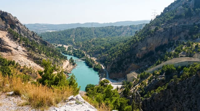
The Hoge Kempen was designated in 2006 as the first national park in Belgium, covering around twelve thousand hectares of a sandy plateau in eastern Limburg with heather, pine plantation, oak and birch woodland, fens, and a series of flooded gravel and sand quarries that have become lakes with unusually clear turquoise water. Its history is industrial: the area was coal country, and the park sits between the old mining towns, with the pine planted originally for pit props. Six gateways with visitor facilities give access to a network of marked walking and cycling routes, and the Mechelse Heide and the Kattevennen observatory area are the best known sections. Heather flowering in late summer is the peak.
History
The park was first set up in 1990 within the regional landscape of Kempen and Maasland, as part of a policy to advance nature reserves in Flanders, and it opened as the first national park of Flanders on Sunday 29 March 2006, covering 67 square kilometres of mostly heath and pine forest. In the 1990s it gave birth to the numbered-node cycle network, designed by Hugo Bollen, now used widely, and in May 2011 it was placed on UNESCO's tentative list (Wikipedia, Hoge Kempen National Park).
What you'll find
- Heather in late summer - the plateau in flower in August and September.
- Flooded quarry lakes - turquoise water in worked-out gravel pits.
- Pine planted for pit props - the mining legacy in the woodland.
- Six visitor gateways - marked routes from each entrance.
When to go
August and September for the heather; spring for birds and autumn for colour. Half a day for one gateway, two days to cover several. Weekends are busy near the gateways. Fire risk closes areas in dry summers.
Good to know
It is a national park by Belgian standards and small by international ones, with roads and towns close on all sides. Quarry lakes are mostly fenced and swimming is prohibited. Fire closures happen in dry weather. Ticks are present.
Nearby
C-mine at Genk is on the western edge; Maasmechelen lies east.
Key facts
Source: Wikidata, item Q1332374, read on 18 October 2026.
What to pack for Hoge Kempen National Park
Chosen from what this place is for. Tap a kit for the full checklist.
- Broken-in walking shoes or boots - Grip and ankle support matter more than looks; never hike in brand-new boots. Find on Amazon
- Reef-safe sunscreen - High SPF that will not bleach the coral you are swimming over. Find on Amazon
- Padded shorts - The one thing that makes a full day in the saddle bearable. Find on Amazon
- Binoculars - The single best wildlife tool - even a compact pair transforms a sighting. Find on Amazon
Some links on this page are Amazon affiliate links - if you buy through them we may earn a small commission at no extra cost to you.
All packing kitsPlan your trip
Where to start if Hoge Kempen National Park is going on the list.
Booking links on this page are affiliate links - if you book through them we may earn a small commission at no extra cost to you. It never changes what we write about a place.
Opening times, ticket prices and seasonal closures change - check the official source before you go: official site.