Hackleton's Cliff
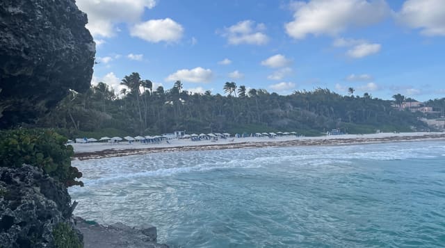
A limestone escarpment running along the eastern side of the island, the edge of an ancient coral terrace three hundred metres up.
Updated 3 September 2026
Barbados is not a volcanic island: it was pushed up from the sea floor as a stack of coral terraces, and Hackleton's Cliff is the edge of one of them, a limestone escarpment running for several kilometres along the eastern side at around three hundred metres, with the Scotland District below it. That district is the only part of the island where the coral cap has eroded through to the older rock beneath, which is why it looks and behaves differently from everywhere else, with landslips, gullies and clay soil. The cliff road runs along the top with viewpoints, and St John's church sits on the lip.
What's there
- The escarpment - the edge of an uplifted coral terrace.
- The Scotland District below - the only place the coral cap has eroded through.
- The viewpoints - along the ridge road, with the Atlantic beyond.
- St John's church - on the lip of the cliff.
When to go
December to April is the dry season and clearest. Mornings face the light correctly for the eastward view. The ridge road is narrow and slow. Rain makes the Scotland District roads below difficult.
Things to know
There is no formal viewpoint or facility, just pull-offs on a narrow road. The best views require knowing where to stop. The Scotland District below is prone to landslips and roads there are frequently damaged. It is a drive rather than a walk.
Nearby
St John's church is on the cliff; Bathsheba is below on the coast.
What to pack for Hackleton's Cliff
Chosen from what this place is for. Tap a kit for the full checklist.
- Broken-in walking shoes or boots - Grip and ankle support matter more than looks; never hike in brand-new boots. Find on Amazon
- Spare batteries + cards - Cold and long shoots drain power; never run out at the good light. Find on Amazon
- Layers + a waterproof shell - Mountain weather turns fast; a packable rain jacket saves the day. Find on Amazon
- A compact tripod - Essential for night skies, aurora, waterfalls and low light. Find on Amazon
Some links on this page are Amazon affiliate links - if you buy through them we may earn a small commission at no extra cost to you.
All packing kitsPlan your trip
Where to start if Hackleton's Cliff is going on the list.
Booking links on this page are affiliate links - if you book through them we may earn a small commission at no extra cost to you. It never changes what we write about a place.
Opening times, ticket prices and seasonal closures change - check the official source before you go: official site.